
Overview
About this route
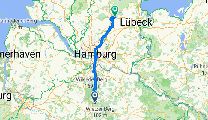
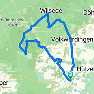
Feinplanung Bad Segeberg - München - Bad Segeberg
- Abschnitt Schneverdingen - SE
- 8 h 54 min
- Duration
- 131.2 km
- Distance
- 691 m
- Ascent
- 712 m
- Descent
- 14.7 km/h
- Avg. speed
- 125 m
- Max. altitude

Part of
20250825 Niedersachsen
8 stages
Route quality
Waytypes & surfaces along the route
Waytypes
Quiet road
48.5 km
(37 %)
Path
31.5 km
(24 %)
Surfaces
Paved
91.8 km
(70 %)
Unpaved
18.4 km
(14 %)
Asphalt
80 km
(61 %)
Paved (undefined)
9.2 km
(7 %)
Continue with Bikemap
Use, edit, or download this cycling route
You would like to ride 8 Bispingen SE or customize it for your own trip? Here is what you can do with this Bikemap route:
Free features
- Save this route as favorite or in collections
- Copy & plan your own version of this route
- Split it into stages to create a multi-day tour
- Sync your route with Garmin or Wahoo
Premium features
Free trial for 3 days, or one-time payment. More about Bikemap Premium.
- Navigate this route on iOS & Android
- Export a GPX / KML file of this route
- Create your custom printout (try it for free)
- Download this route for offline navigation
Discover more Premium features.
Get Bikemap PremiumFrom our community
Other popular routes starting in Bispingen
 Wd06-Kleine-Heidetour-27km
- Distance
- 27.2 km
- Ascent
- 204 m
- Descent
- 196 m
- Location
- Bispingen, Lower Saxony, Germany
 Bispingen-Steinbeck-Volkwardingen-Totengrund-Bispingen
- Distance
- 27.3 km
- Ascent
- 145 m
- Descent
- 148 m
- Location
- Bispingen, Lower Saxony, Germany
 Wd08-Wildpark-Lüneburger-Heide-49km
- Distance
- 49.1 km
- Ascent
- 473 m
- Descent
- 471 m
- Location
- Bispingen, Lower Saxony, Germany
 Wuemmeberg-Tour - Bispingen
- Distance
- 33.8 km
- Ascent
- 174 m
- Descent
- 174 m
- Location
- Bispingen, Lower Saxony, Germany
 test
test- Distance
- 25.5 km
- Ascent
- 163 m
- Descent
- 160 m
- Location
- Bispingen, Lower Saxony, Germany
 Schnuckentour
- Distance
- 31.2 km
- Ascent
- 161 m
- Descent
- 161 m
- Location
- Bispingen, Lower Saxony, Germany
 Bispingen-Schwindequelle
- Distance
- 31.9 km
- Ascent
- 120 m
- Descent
- 119 m
- Location
- Bispingen, Lower Saxony, Germany
 Heidetour groß
- Distance
- 40.7 km
- Ascent
- 204 m
- Descent
- 202 m
- Location
- Bispingen, Lower Saxony, Germany
Open it in the app