

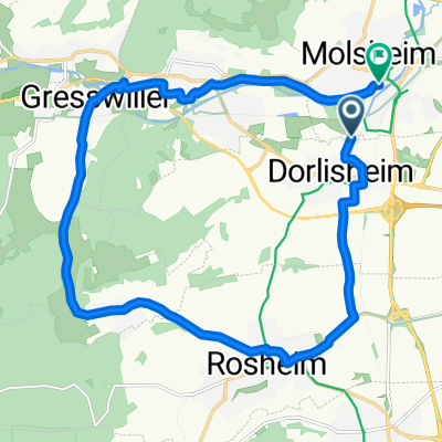
Mont saint odile
A cycling route starting in Dorlisheim, Grand Est, France.
Overview
About this route
- -:--
- Duration
- 70.4 km
- Distance
- 1,314 m
- Ascent
- 1,310 m
- Descent
- ---
- Avg. speed
- ---
- Max. altitude

Route quality
Waytypes & surfaces along the route
Waytypes
Road
9.9 km
(14 %)
Quiet road
9.2 km
(13 %)
Surfaces
Paved
28.9 km
(41 %)
Asphalt
28.9 km
(41 %)
Undefined
41.5 km
(59 %)
Continue with Bikemap
Use, edit, or download this cycling route
You would like to ride Mont saint odile or customize it for your own trip? Here is what you can do with this Bikemap route:
Free features
- Save this route as favorite or in collections
- Copy & plan your own version of this route
- Sync your route with Garmin or Wahoo
Premium features
Free trial for 3 days, or one-time payment. More about Bikemap Premium.
- Navigate this route on iOS & Android
- Export a GPX / KML file of this route
- Create your custom printout (try it for free)
- Download this route for offline navigation
Discover more Premium features.
Get Bikemap PremiumFrom our community
Other popular routes starting in Dorlisheim
 Dorlisheim 49Km 540m
- Distance
- 48.5 km
- Ascent
- 438 m
- Descent
- 438 m
- Location
- Dorlisheim, Grand Est, France
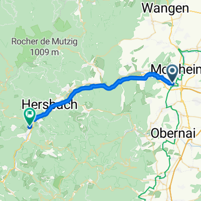
 Molsheim 55km - Autour (chemin)
- Distance
- 50.9 km
- Ascent
- 577 m
- Descent
- 577 m
- Location
- Dorlisheim, Grand Est, France
 Mont saint odile
- Distance
- 70.4 km
- Ascent
- 1,314 m
- Descent
- 1,310 m
- Location
- Dorlisheim, Grand Est, France
 Abo Press
- Distance
- 24.8 km
- Ascent
- 48 m
- Descent
- 86 m
- Location
- Dorlisheim, Grand Est, France
 Chemin de Dorlisheim, Molsheim à Rue Sainte-Odile, Molsheim
- Distance
- 18.4 km
- Ascent
- 165 m
- Descent
- 176 m
- Location
- Dorlisheim, Grand Est, France
 Randonnée permanente USPU
- Distance
- 87.7 km
- Ascent
- 1,050 m
- Descent
- 1,051 m
- Location
- Dorlisheim, Grand Est, France
 Dorlisheim - La Broque
- Distance
- 26 km
- Ascent
- 326 m
- Descent
- 182 m
- Location
- Dorlisheim, Grand Est, France
 vins crêtes
- Distance
- 142.5 km
- Ascent
- 1,760 m
- Descent
- 1,484 m
- Location
- Dorlisheim, Grand Est, France
Open it in the app