

Routes around Le Peyrat
Le Peyrat - Col du Pradel
A cycling route starting in Bélesta, Occitanie, France.
Overview
About this route
- 6 h 40 min
- Duration
- 108.3 km
- Distance
- 1,823 m
- Ascent
- 1,823 m
- Descent
- 16.2 km/h
- Avg. speed
- ---
- Max. altitude

Part of
Routes around Le Peyrat
11 stages
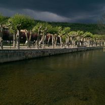
Route photos


Route quality
Waytypes & surfaces along the route
Waytypes
Road
9.7 km
(9 %)
Quiet road
3.2 km
(3 %)
Surfaces
Paved
49.8 km
(46 %)
Unpaved
1.1 km
(1 %)
Asphalt
49.8 km
(46 %)
Ground
1.1 km
(1 %)
Undefined
57.4 km
(53 %)
Continue with Bikemap
Use, edit, or download this cycling route
You would like to ride Le Peyrat - Col du Pradel or customize it for your own trip? Here is what you can do with this Bikemap route:
Free features
- Save this route as favorite or in collections
- Copy & plan your own version of this route
- Split it into stages to create a multi-day tour
- Sync your route with Garmin or Wahoo
Premium features
Free trial for 3 days, or one-time payment. More about Bikemap Premium.
- Navigate this route on iOS & Android
- Export a GPX / KML file of this route
- Create your custom printout (try it for free)
- Download this route for offline navigation
Discover more Premium features.
Get Bikemap PremiumFrom our community
Other popular routes starting in Bélesta
 Le Peyrat - Col du Pradel
- Distance
- 108.3 km
- Ascent
- 1,823 m
- Descent
- 1,823 m
- Location
- Bélesta, Occitanie, France
 Around Montbel
- Distance
- 26.9 km
- Ascent
- 474 m
- Descent
- 475 m
- Location
- Bélesta, Occitanie, France
 Plateau de Sault et Port de Pailhères (Ariège 2017)
- Distance
- 73.8 km
- Ascent
- 2,067 m
- Descent
- 2,067 m
- Location
- Bélesta, Occitanie, France
 Le Bete
- Distance
- 139.5 km
- Ascent
- 1,898 m
- Descent
- 1,896 m
- Location
- Bélesta, Occitanie, France
 44k Le Peyrat-Chalabre-Col du Tuquet - Puivert
- Distance
- 44.3 km
- Ascent
- 612 m
- Descent
- 615 m
- Location
- Bélesta, Occitanie, France
 2014 Ride Day 46 - Bélesta Circle through Puivert, Castelreng, Chalabre, and Lesparrou
- Distance
- 81.6 km
- Ascent
- 1,153 m
- Descent
- 1,157 m
- Location
- Bélesta, Occitanie, France
 MBEspezel
- Distance
- 17.5 km
- Ascent
- 554 m
- Descent
- 552 m
- Location
- Bélesta, Occitanie, France
 Le Peyrat-Espezel-Puivert 50k
- Distance
- 56.2 km
- Ascent
- 635 m
- Descent
- 632 m
- Location
- Bélesta, Occitanie, France
Open it in the app