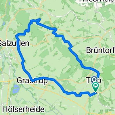
Lemgo Lage
- 10.8 km
- 41 m
- 48 m
- Lemgo, North Rhine-Westphalia, Germany
A cycling route starting in Lemgo, North Rhine-Westphalia, Germany.
Overview
Ottenstein Plateau in version four.
Route length: 91.2 kilometers
Average speed: 26.2 km/h
Calorie consumption: 3966 kcal
Active riding time: 3 hours and 45 minutes
Maximum speed: 68.4 km/h
Total ascent: 1181 meters
Total descent: s.o.
Max. height: 369 meters
Starting height: 110 meters (for 32657 Voßheide)
Route length before post-processing: 91.7 kilometers
Post-processing time: 2 hours and 15 minutes
created this 8 years ago
Route quality
Road
32.8 km
(36 %)
Path
14.6 km
(16 %)
Paved
78.4 km
(86 %)
Unpaved
1.8 km
(2 %)
Asphalt
74.8 km
(82 %)
Paved (undefined)
3.6 km
(4 %)
Continue with Bikemap
You would like to ride Ottenstein V5 or customize it for your own trip? Here is what you can do with this Bikemap route:
Free trial for 3 days, or one-time payment. More about Bikemap Premium.
Discover more Premium features.
Get Bikemap PremiumFrom our community
Open it in the app