

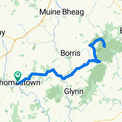
Thomastown Kilkenny Ennisnag Home
A cycling route starting in Thomastown, Leinster, Ireland.
Overview
About this route
- -:--
- Duration
- 43.6 km
- Distance
- 192 m
- Ascent
- 192 m
- Descent
- ---
- Avg. speed
- ---
- Avg. speed

Route quality
Waytypes & surfaces along the route
Waytypes
Busy road
27.8 km
(64 %)
Cycleway
5.1 km
(12 %)
Surfaces
Paved
23.6 km
(54 %)
Asphalt
22 km
(50 %)
Paved (undefined)
1.6 km
(4 %)
Undefined
20 km
(46 %)
Continue with Bikemap
Use, edit, or download this cycling route
You would like to ride Thomastown Kilkenny Ennisnag Home or customize it for your own trip? Here is what you can do with this Bikemap route:
Free features
- Save this route as favorite or in collections
- Copy & plan your own version of this route
- Sync your route with Garmin or Wahoo
Premium features
Free trial for 3 days, or one-time payment. More about Bikemap Premium.
- Navigate this route on iOS & Android
- Export a GPX / KML file of this route
- Create your custom printout (try it for free)
- Download this route for offline navigation
Discover more Premium features.
Get Bikemap PremiumFrom our community
Other popular routes starting in Thomastown
 TT-Stoney-Tull-Mong0-BB
- Distance
- 42.2 km
- Ascent
- 360 m
- Descent
- 361 m
- Location
- Thomastown, Leinster, Ireland
 Thomastown Mt Leinster
- Distance
- 84 km
- Ascent
- 1,281 m
- Descent
- 1,282 m
- Location
- Thomastown, Leinster, Ireland
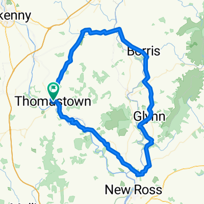
 Thomastown Stoneyford Tullaherin
- Distance
- 24.4 km
- Ascent
- 192 m
- Descent
- 193 m
- Location
- Thomastown, Leinster, Ireland
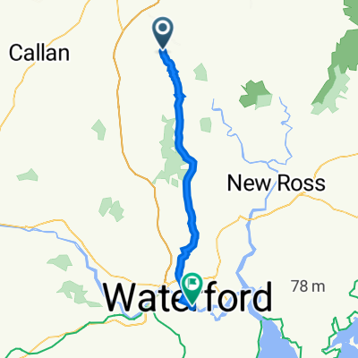
 New Ross Run
- Distance
- 73.7 km
- Ascent
- 518 m
- Descent
- 518 m
- Location
- Thomastown, Leinster, Ireland
 Thomastown Kilkenny Ennisnag Home
- Distance
- 43.6 km
- Ascent
- 192 m
- Descent
- 192 m
- Location
- Thomastown, Leinster, Ireland
 Nore Valley to Kilclooney Wood
- Distance
- 47.3 km
- Ascent
- 579 m
- Descent
- 486 m
- Location
- Thomastown, Leinster, Ireland
 yippie
- Distance
- 38.1 km
- Ascent
- 385 m
- Descent
- 451 m
- Location
- Thomastown, Leinster, Ireland
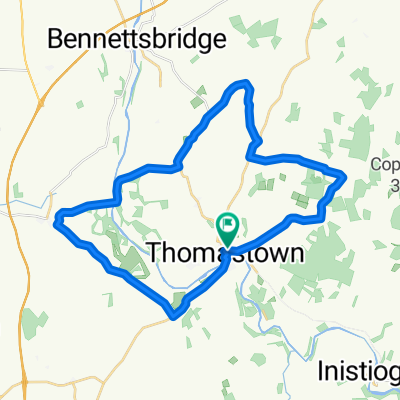 Thomastown Stoneyford Tullaherin Mong
- Distance
- 29.6 km
- Ascent
- 255 m
- Descent
- 255 m
- Location
- Thomastown, Leinster, Ireland
Open it in the app