

Lengthy bike tour through St-Légier-Chiésaz
A cycling route starting in Blonay, Canton of Vaud, Switzerland.
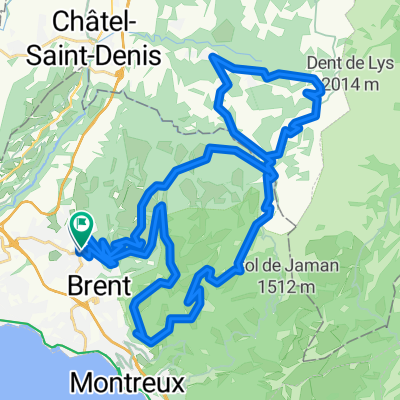
Overview
About this route
- -:--
- Duration
- 44.2 km
- Distance
- 1,245 m
- Ascent
- 1,246 m
- Descent
- ---
- Avg. speed
- ---
- Max. altitude
Route quality
Waytypes & surfaces along the route
Waytypes
Quiet road
17.7 km
(40 %)
Track
14.6 km
(33 %)
Surfaces
Paved
15.9 km
(36 %)
Unpaved
2.6 km
(6 %)
Paved (undefined)
13.2 km
(30 %)
Asphalt
2.6 km
(6 %)
Route highlights
Points of interest along the route
Photo after 44.1 km
Home
Continue with Bikemap
Use, edit, or download this cycling route
You would like to ride Lengthy bike tour through St-Légier-Chiésaz or customize it for your own trip? Here is what you can do with this Bikemap route:
Free features
- Save this route as favorite or in collections
- Copy & plan your own version of this route
- Sync your route with Garmin or Wahoo
Premium features
Free trial for 3 days, or one-time payment. More about Bikemap Premium.
- Navigate this route on iOS & Android
- Export a GPX / KML file of this route
- Create your custom printout (try it for free)
- Download this route for offline navigation
Discover more Premium features.
Get Bikemap PremiumFrom our community
Other popular routes starting in Blonay
 Pacots
- Distance
- 37.7 km
- Ascent
- 776 m
- Descent
- 779 m
- Location
- Blonay, Canton of Vaud, Switzerland
 Provence na kole 2.den-www.nomad.cz
- Distance
- 52.7 km
- Ascent
- 605 m
- Descent
- 1,478 m
- Location
- Blonay, Canton of Vaud, Switzerland
 Lengthy bike tour through St-Légier-Chiésaz
- Distance
- 44.2 km
- Ascent
- 1,245 m
- Descent
- 1,246 m
- Location
- Blonay, Canton of Vaud, Switzerland
 Blonay-Chatel-Bossonnens-Jongny-Brent
- Distance
- 26.6 km
- Ascent
- 554 m
- Descent
- 555 m
- Location
- Blonay, Canton of Vaud, Switzerland
 chablais vaudois
- Distance
- 47.7 km
- Ascent
- 1,664 m
- Descent
- 1,655 m
- Location
- Blonay, Canton of Vaud, Switzerland
 Blonay - Lutry WayBack
- Distance
- 20.2 km
- Ascent
- 294 m
- Descent
- 472 m
- Location
- Blonay, Canton of Vaud, Switzerland
 Col de Jaman
- Distance
- 43.8 km
- Ascent
- 1,305 m
- Descent
- 1,307 m
- Location
- Blonay, Canton of Vaud, Switzerland
 De Chemin de Pangires, St-Légier-Chiésaz à Route de Châtel-Saint-Denis 26, Blonay
- Distance
- 3 km
- Ascent
- 162 m
- Descent
- 26 m
- Location
- Blonay, Canton of Vaud, Switzerland
Open it in the app