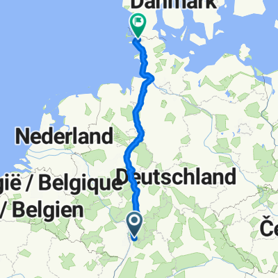
Vordere Odenwald Runde
A cycling route starting in Weinheim, Baden-Württemberg, Germany.
Overview
About this route
Über Fürth, Reichelsheim,Fischbachtal und Modautal nach Bensheim und dann zurück nach Weinheim
- -:--
- Duration
- 79.7 km
- Distance
- 586 m
- Ascent
- 586 m
- Descent
- ---
- Avg. speed
- ---
- Avg. speed
Continue with Bikemap
Use, edit, or download this cycling route
You would like to ride Vordere Odenwald Runde or customize it for your own trip? Here is what you can do with this Bikemap route:
Free features
- Save this route as favorite or in collections
- Copy & plan your own version of this route
- Sync your route with Garmin or Wahoo
Premium features
Free trial for 3 days, or one-time payment. More about Bikemap Premium.
- Navigate this route on iOS & Android
- Export a GPX / KML file of this route
- Create your custom printout (try it for free)
- Download this route for offline navigation
Discover more Premium features.
Get Bikemap PremiumFrom our community
Other popular routes starting in Weinheim
- Rough Ride Ried 20200119
- Distance
- 103.5 km
- Ascent
- 99 m
- Descent
- 102 m
- Location
- Weinheim, Baden-Württemberg, Germany
- Weinheim - Darmstadt
- Distance
- 79.3 km
- Ascent
- 1,109 m
- Descent
- 1,071 m
- Location
- Weinheim, Baden-Württemberg, Germany
- Wh,Abtst.Helig. Schrh.Wh.
- Distance
- 40.5 km
- Ascent
- 503 m
- Descent
- 502 m
- Location
- Weinheim, Baden-Württemberg, Germany
- Flache runde über HPH
- Distance
- 48.4 km
- Ascent
- 123 m
- Descent
- 123 m
- Location
- Weinheim, Baden-Württemberg, Germany
- Wh - Hh. Eberb. HD. Wh
- Distance
- 95.3 km
- Ascent
- 880 m
- Descent
- 879 m
- Location
- Weinheim, Baden-Württemberg, Germany
- Weinheim-Nächstenbach-4Ritter-Liebersbach-Juhöhe-HP-Burgen Blüten
- Distance
- 28.3 km
- Ascent
- 566 m
- Descent
- 566 m
- Location
- Weinheim, Baden-Württemberg, Germany
- Vordere Odenwald Runde
- Distance
- 79.7 km
- Ascent
- 586 m
- Descent
- 586 m
- Location
- Weinheim, Baden-Württemberg, Germany
- Weinheim - Neckarsteinach Burgen
- Distance
- 60 km
- Ascent
- 1,107 m
- Descent
- 1,123 m
- Location
- Weinheim, Baden-Württemberg, Germany
Open it in the app