

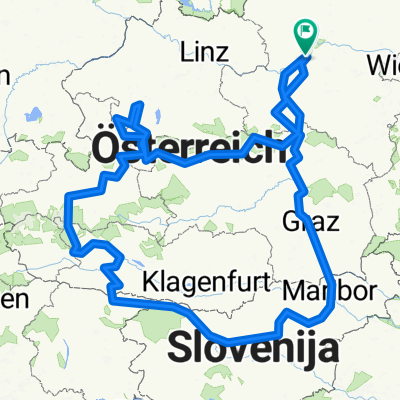
A 210 Aggsbach-Wien
A cycling route starting in Aggsbach, Lower Austria, Austria.
Overview
About this route
Aggsbach-Wien
Strandhotel Alte Donau
Wagramer Str. 51, 1220 Wien, Österreich
strandhotel-alte-donau.at
+43 1 2044040
- -:--
- Duration
- 116 km
- Distance
- 42 m
- Ascent
- 91 m
- Descent
- ---
- Avg. speed
- ---
- Max. altitude

Route quality
Waytypes & surfaces along the route
Waytypes
Track
55.1 km
(48 %)
Cycleway
24.1 km
(21 %)
Surfaces
Paved
107.8 km
(93 %)
Unpaved
3.9 km
(3 %)
Asphalt
105.9 km
(91 %)
Gravel
2.5 km
(2 %)
Continue with Bikemap
Use, edit, or download this cycling route
You would like to ride A 210 Aggsbach-Wien or customize it for your own trip? Here is what you can do with this Bikemap route:
Free features
- Save this route as favorite or in collections
- Copy & plan your own version of this route
- Split it into stages to create a multi-day tour
- Sync your route with Garmin or Wahoo
Premium features
Free trial for 3 days, or one-time payment. More about Bikemap Premium.
- Navigate this route on iOS & Android
- Export a GPX / KML file of this route
- Create your custom printout (try it for free)
- Download this route for offline navigation
Discover more Premium features.
Get Bikemap PremiumFrom our community
Other popular routes starting in Aggsbach
 Aggsbach-Alpen
- Distance
- 1,258.7 km
- Ascent
- 5,521 m
- Descent
- 5,372 m
- Location
- Aggsbach, Lower Austria, Austria
 WILLENDORF-ZWENTENDORF (6A)
- Distance
- 52.3 km
- Ascent
- 86 m
- Descent
- 120 m
- Location
- Aggsbach, Lower Austria, Austria
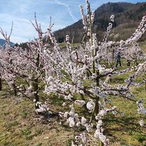 Marillenblüte in der Wachau 23.3.23
- Distance
- 54.5 km
- Ascent
- 484 m
- Descent
- 484 m
- Location
- Aggsbach, Lower Austria, Austria
 Aggstein-Runde
- Distance
- 20 km
- Ascent
- 650 m
- Descent
- 646 m
- Location
- Aggsbach, Lower Austria, Austria
 D8_Aggsbach Markt-Viena
- Distance
- 114.8 km
- Ascent
- 156 m
- Descent
- 160 m
- Location
- Aggsbach, Lower Austria, Austria
 Long bike tour from Aggsbach - Dorf to Gemeinde Schönbühel-Aggsbach
- Distance
- 69.7 km
- Ascent
- 172 m
- Descent
- 172 m
- Location
- Aggsbach, Lower Austria, Austria
 Aggsbach-Dorf nach Innerhörgersteig
- Distance
- 246 km
- Ascent
- 2,379 m
- Descent
- 2,082 m
- Location
- Aggsbach, Lower Austria, Austria
 A 210 Aggsbach-Wien
- Distance
- 116 km
- Ascent
- 42 m
- Descent
- 91 m
- Location
- Aggsbach, Lower Austria, Austria
Open it in the app