SVK7
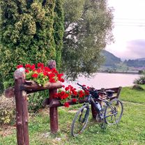
A cycling route starting in Dobšiná, Košice Region, Slovakia.
Overview
About this route
Rožnava-Silicka Brezova-Plešivec-Tornala-Rimavska Sobota
- -:--
- Duration
- 75.8 km
- Distance
- 539 m
- Ascent
- 813 m
- Descent
- ---
- Avg. speed
- ---
- Max. altitude
Route quality
Waytypes & surfaces along the route
Waytypes
Road
18.2 km
(24 %)
Quiet road
12.1 km
(16 %)
Surfaces
Paved
41 km
(54 %)
Unpaved
4.6 km
(6 %)
Asphalt
39.4 km
(52 %)
Gravel
3 km
(4 %)
Continue with Bikemap
Use, edit, or download this cycling route
You would like to ride SVK7 or customize it for your own trip? Here is what you can do with this Bikemap route:
Free features
- Save this route as favorite or in collections
- Copy & plan your own version of this route
- Sync your route with Garmin or Wahoo
Premium features
Free trial for 3 days, or one-time payment. More about Bikemap Premium.
- Navigate this route on iOS & Android
- Export a GPX / KML file of this route
- Create your custom printout (try it for free)
- Download this route for offline navigation
Discover more Premium features.
Get Bikemap PremiumFrom our community
Other popular routes starting in Dobšiná
- Zelená stuha Horehronia
- Distance
- 54.8 km
- Ascent
- 979 m
- Descent
- 1,246 m
- Location
- Dobšiná, Košice Region, Slovakia
- Šumiac, Kráľová Hoľa, Bartková,Pohorelá Šumiac
- Distance
- 39.1 km
- Ascent
- 1,338 m
- Descent
- 1,337 m
- Location
- Dobšiná, Košice Region, Slovakia
- Dedinky - Stratená - Stratenský kaňon - Dobšinská Maša - Dedinky CLONED FROM ROUTE 582102
- Distance
- 14.3 km
- Ascent
- 449 m
- Descent
- 445 m
- Location
- Dobšiná, Košice Region, Slovakia
- Iglói kör
- Distance
- 64.7 km
- Ascent
- 958 m
- Descent
- 957 m
- Location
- Dobšiná, Košice Region, Slovakia
- KH-Certovica
- Distance
- 42 km
- Ascent
- 1,110 m
- Descent
- 1,803 m
- Location
- Dobšiná, Košice Region, Slovakia
- Kráľova Hoľa
- Distance
- 23.8 km
- Ascent
- 1,024 m
- Descent
- 1,009 m
- Location
- Dobšiná, Košice Region, Slovakia
- SK/Telgárt - PL/Zakopane
- Distance
- 98.8 km
- Ascent
- 1,877 m
- Descent
- 1,820 m
- Location
- Dobšiná, Košice Region, Slovakia
- Telgárt - Mlynky - Nálepkovo - Gelnica - Margecany - Košice
- Distance
- 139.9 km
- Ascent
- 2,169 m
- Descent
- 2,837 m
- Location
- Dobšiná, Košice Region, Slovakia
Open it in the app