

2-Tag_Aosta-ValD-isere
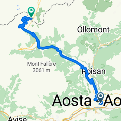
A cycling route starting in Aosta, Aosta Valley, Italy.
Overview
About this route
- Tag Rennradausfahrt mit Handstanger
Von Aosta fahren wir bis kurz vor Courmayeur ca. 40 km taleinwärts und gewinnen dabei 400 m an Höhe, hier müssen wir zum Teil mit stärkerem Verkehr rechnen. Wir sehen das Mont Blanc Massiv zum Greifen nahe vor uns. In Pré St. Didier zweigen wir auf die Straße zum Kleinen St. Bernhard ab. So klein ist er auch nicht, sind doch von hier bis zur Passhöhe immerhin 24 km und 1.200 HM bis auf 2.188 m zu bewältigen. Allerdings beträgt die max. Steigung nur 9 %. Anfangs fahren wir durch eine enge Schlucht aufwärts ca. 10 km bis La Thuile – einem Sommer- und Wintersportort. Nun öffnet sich das Tal und wir fahren über mehrere Kehrengruppen bei mäßiger Steigung in Richtung Passhöhe, wo wir eine ordentliche Rast einlegen. Es folgt eine lange, aber nur im oberen Teil steilere Abfahrt in Richtung Bourg-St.-Maurice. Bald nachdem wir den Wintersportort La Rosière erreicht haben zweigen wir jedoch von der Passstraße ab und benützen kleinere Nebenstraßen in Richtung Val d’Isère. Dadurch ersparen wir uns, einige Hundert Höhenmeter und in Sainte -Foy -Tarentaise treffen wir auf die Hauptstraße hinauf nach Val d’Isére. Der Anstieg hat es in sich und bis zum Lac de Tigne führt die Straße in mehreren steileren Passagen bis auf 1.800 m hinauf. Vom Lac de Tignes haben wir einen herrlichen Anblick auf den Retortenort Tignes. Von hier führt die Straße durch Lawinengalerien bis zu einem schmalen Durchgang und plötzlich öffnet sich das Tal und Val d’Isére – der legendäre Sommer- und Wintersportort – liegt vor uns.
- -:--
- Duration
- 94.3 km
- Distance
- 2,400 m
- Ascent
- 1,177 m
- Descent
- ---
- Avg. speed
- ---
- Max. altitude

Route quality
Waytypes & surfaces along the route
Waytypes
Busy road
72.4 km
(77 %)
Quiet road
11.9 km
(13 %)
Surfaces
Paved
71.1 km
(75 %)
Unpaved
0.4 km
(<1 %)
Asphalt
70.7 km
(75 %)
Paving stones
0.4 km
(<1 %)
Continue with Bikemap
Use, edit, or download this cycling route
You would like to ride 2-Tag_Aosta-ValD-isere or customize it for your own trip? Here is what you can do with this Bikemap route:
Free features
- Save this route as favorite or in collections
- Copy & plan your own version of this route
- Split it into stages to create a multi-day tour
- Sync your route with Garmin or Wahoo
Premium features
Free trial for 3 days, or one-time payment. More about Bikemap Premium.
- Navigate this route on iOS & Android
- Export a GPX / KML file of this route
- Create your custom printout (try it for free)
- Download this route for offline navigation
Discover more Premium features.
Get Bikemap PremiumFrom our community
Other popular routes starting in Aosta
 4 - Aosta - Innertkirchen
- Distance
- 428.6 km
- Ascent
- 6,681 m
- Descent
- 6,634 m
- Location
- Aosta, Aosta Valley, Italy
 F52 aosta to nus
- Distance
- 14.3 km
- Ascent
- 48 m
- Descent
- 85 m
- Location
- Aosta, Aosta Valley, Italy
 Aosta-Via dei salassi
- Distance
- 58.7 km
- Ascent
- 1,736 m
- Descent
- 1,734 m
- Location
- Aosta, Aosta Valley, Italy
 Alps 1991 18.8. Tag4b
- Distance
- 79.5 km
- Ascent
- 1,881 m
- Descent
- 1,973 m
- Location
- Aosta, Aosta Valley, Italy
 Aosta-Lago di Place Moulin-retour
- Distance
- 63.4 km
- Ascent
- 1,415 m
- Descent
- 1,415 m
- Location
- Aosta, Aosta Valley, Italy
 Aosta
Aosta- Distance
- 472.3 km
- Ascent
- 6,494 m
- Descent
- 6,494 m
- Location
- Aosta, Aosta Valley, Italy
 Col du Gd-St Bernard
- Distance
- 36.9 km
- Ascent
- 1,917 m
- Descent
- 23 m
- Location
- Aosta, Aosta Valley, Italy
 Alpencross 2007/2 - Aosta bis GranParadiso
- Distance
- 43.2 km
- Ascent
- 2,071 m
- Descent
- 48 m
- Location
- Aosta, Aosta Valley, Italy
Open it in the app