

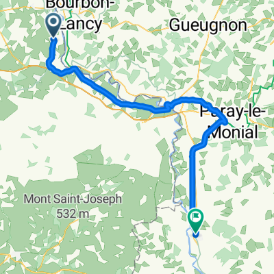
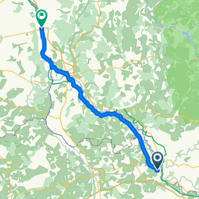
20170814_072908.gpx
A cycling route starting in Beaulon, Auvergne-Rhône-Alpes, France.
Overview
About this route
TAHUNA track
- -:--
- Duration
- 63.5 km
- Distance
- 64 m
- Ascent
- 67 m
- Descent
- ---
- Avg. speed
- ---
- Max. altitude
Route quality
Waytypes & surfaces along the route
Waytypes
Quiet road
36.2 km
(57 %)
Road
7.6 km
(12 %)
Surfaces
Paved
10.2 km
(16 %)
Asphalt
10.2 km
(16 %)
Undefined
53.4 km
(84 %)
Continue with Bikemap
Use, edit, or download this cycling route
You would like to ride 20170814_072908.gpx or customize it for your own trip? Here is what you can do with this Bikemap route:
Free features
- Save this route as favorite or in collections
- Copy & plan your own version of this route
- Sync your route with Garmin or Wahoo
Premium features
Free trial for 3 days, or one-time payment. More about Bikemap Premium.
- Navigate this route on iOS & Android
- Export a GPX / KML file of this route
- Create your custom printout (try it for free)
- Download this route for offline navigation
Discover more Premium features.
Get Bikemap PremiumFrom our community
Other popular routes starting in Beaulon
 Beaulon - Marcigny
- Distance
- 66.8 km
- Ascent
- 142 m
- Descent
- 102 m
- Location
- Beaulon, Auvergne-Rhône-Alpes, France
 20170814_072908.gpx
- Distance
- 63.5 km
- Ascent
- 64 m
- Descent
- 67 m
- Location
- Beaulon, Auvergne-Rhône-Alpes, France
 beaulon val d'epy
- Distance
- 157 km
- Ascent
- 2,844 m
- Descent
- 2,682 m
- Location
- Beaulon, Auvergne-Rhône-Alpes, France
 Beaulon - La Charité-sur-Loire
- Distance
- 103.5 km
- Ascent
- 166 m
- Descent
- 218 m
- Location
- Beaulon, Auvergne-Rhône-Alpes, France
 Garnat-sur-engièvre 60 km
- Distance
- 74.1 km
- Ascent
- 133 m
- Descent
- 133 m
- Location
- Beaulon, Auvergne-Rhône-Alpes, France
Open it in the app