

Karkonosze (ring)
A cycling route starting in Cieplice Śląskie Zdrój, Lower Silesian Voivodeship, Poland.
Overview
About this route
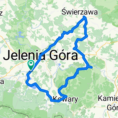
Sobieszów - Podgórzyn - Przesieka - Špindlerův Mlýn - Vrchlabí - Hrabačov - Hradsko - Jablonec nad Jizerou - Harrachov - Jakuszyce - Szklarska Poręba - Piechowice - Sobieszów
- -:--
- Duration
- 98.4 km
- Distance
- 1,402 m
- Ascent
- 1,402 m
- Descent
- ---
- Avg. speed
- ---
- Max. altitude

Route quality
Waytypes & surfaces along the route
Waytypes
Quiet road
17.7 km
(18 %)
Road
5.9 km
(6 %)
Surfaces
Paved
81.6 km
(83 %)
Asphalt
81.6 km
(83 %)
Undefined
16.7 km
(17 %)
Continue with Bikemap
Use, edit, or download this cycling route
You would like to ride Karkonosze (ring) or customize it for your own trip? Here is what you can do with this Bikemap route:
Free features
- Save this route as favorite or in collections
- Copy & plan your own version of this route
- Split it into stages to create a multi-day tour
- Sync your route with Garmin or Wahoo
Premium features
Free trial for 3 days, or one-time payment. More about Bikemap Premium.
- Navigate this route on iOS & Android
- Export a GPX / KML file of this route
- Create your custom printout (try it for free)
- Download this route for offline navigation
Discover more Premium features.
Get Bikemap PremiumFrom our community
Other popular routes starting in Cieplice Śląskie Zdrój
 Przełęcz Karkonoska & Modré sedlo & Przełęcz Okraj
- Distance
- 117.1 km
- Ascent
- 2,197 m
- Descent
- 2,109 m
- Location
- Cieplice Śląskie Zdrój, Lower Silesian Voivodeship, Poland
 Poudnie Jeleniej Góry
- Distance
- 84.6 km
- Ascent
- 1,220 m
- Descent
- 1,219 m
- Location
- Cieplice Śląskie Zdrój, Lower Silesian Voivodeship, Poland
 Dla mamy
- Distance
- 23.6 km
- Ascent
- 239 m
- Descent
- 237 m
- Location
- Cieplice Śląskie Zdrój, Lower Silesian Voivodeship, Poland
 Odrodzenie
- Distance
- 38.4 km
- Ascent
- 975 m
- Descent
- 973 m
- Location
- Cieplice Śląskie Zdrój, Lower Silesian Voivodeship, Poland
 Klasyk Karkonoski-GMPA
- Distance
- 75.4 km
- Ascent
- 1,524 m
- Descent
- 1,275 m
- Location
- Cieplice Śląskie Zdrój, Lower Silesian Voivodeship, Poland
 Jelenia Góra
- Distance
- 83.9 km
- Ascent
- 855 m
- Descent
- 856 m
- Location
- Cieplice Śląskie Zdrój, Lower Silesian Voivodeship, Poland
 mala petla
- Distance
- 14.2 km
- Ascent
- 212 m
- Descent
- 193 m
- Location
- Cieplice Śląskie Zdrój, Lower Silesian Voivodeship, Poland
 Sudety (05)
- Distance
- 28.4 km
- Ascent
- 648 m
- Descent
- 648 m
- Location
- Cieplice Śląskie Zdrój, Lower Silesian Voivodeship, Poland
Open it in the app