- 22.7 km
- 249 m
- 247 m
- Eutingen an der Enz, Baden-Wurttemberg, Germany
Strombergrunde Eutingen - Bretten - Vaihingen
A cycling route starting in Eutingen an der Enz, Baden-Wurttemberg, Germany.
Overview
About this route
After starting from Pforzheim-Eutingen, first ride up to the Hohberg. From there, follow the Heidelberg-Schwarzwald-Bodensee cycle route to Bretten. Then take field paths and the Weissacher valley to Hohenklingen.
From this point, the route mostly climbs gently up to around Maulbronn. This route variant includes a short, challenging trail shortly before reaching the high point near Maulbronn. Those who prefer not to ride it can follow the path downhill and then make a sharp left onto a long, steep paved climb.
After Maulbronn, the route continues on the Stromberg-Murr cycle path, with the following section to Vaihingen-Kleinglattbach following its course.
Passing Vaihingen station, the route goes through Illingen, Lienzingen, Ötisheim, and Dürrn, then back to the Hohberg and from there back to Pforzheim-Eutingen.
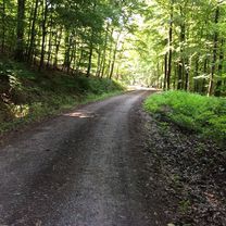
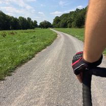
The tour covers various surfaces (asphalt in all conditions, unpaved paths, gravel roads), mostly on field and forest paths. A gravel or cyclocross bike is recommended. A touring bike or hardtail MTB will also suffice if necessary.
- -:--
- Duration
- 82.8 km
- Distance
- 490 m
- Ascent
- 489 m
- Descent
- ---
- Avg. speed
- ---
- Max. altitude
created this 8 years ago
Route photos
Route quality
Waytypes & surfaces along the route
Waytypes
Track
52.1 km
(63 %)
Quiet road
10.8 km
(13 %)
Surfaces
Paved
59.6 km
(72 %)
Unpaved
18.2 km
(22 %)
Asphalt
48.8 km
(59 %)
Gravel
11.6 km
(14 %)
Continue with Bikemap
Use, edit, or download this cycling route
You would like to ride Strombergrunde Eutingen - Bretten - Vaihingen or customize it for your own trip? Here is what you can do with this Bikemap route:
Free features
- Save this route as favorite or in collections
- Copy & plan your own version of this route
- Split it into stages to create a multi-day tour
- Sync your route with Garmin or Wahoo
Premium features
Free trial for 3 days, or one-time payment. More about Bikemap Premium.
- Navigate this route on iOS & Android
- Export a GPX / KML file of this route
- Create your custom printout (try it for free)
- Download this route for offline navigation
Discover more Premium features.
Get Bikemap PremiumFrom our community
Other popular routes starting in Eutingen an der Enz
- Sonntags Tour Pinache
- Enzstraße 92, Pforzheim nach Enzstraße 61, Pforzheim
- 19.1 km
- 227 m
- 226 m
- Eutingen an der Enz, Baden-Wurttemberg, Germany
- standart
- 14.1 km
- 1,333 m
- 1,271 m
- Eutingen an der Enz, Baden-Wurttemberg, Germany
- Schwarzwaldtour 1
- 56.9 km
- 873 m
- 785 m
- Eutingen an der Enz, Baden-Wurttemberg, Germany
- Schöne MTB Route
- 9.8 km
- 164 m
- 163 m
- Eutingen an der Enz, Baden-Wurttemberg, Germany
- Pforzheim nach Haidachstraße 37, Pforzheim
- 12.5 km
- 381 m
- 0 m
- Eutingen an der Enz, Baden-Wurttemberg, Germany
- Strombergrunde Eutingen - Bretten - Vaihingen
- 82.8 km
- 490 m
- 489 m
- Eutingen an der Enz, Baden-Wurttemberg, Germany
- Enztal-Radweg
- 53.6 km
- 181 m
- 255 m
- Eutingen an der Enz, Baden-Wurttemberg, Germany
Open it in the app


