

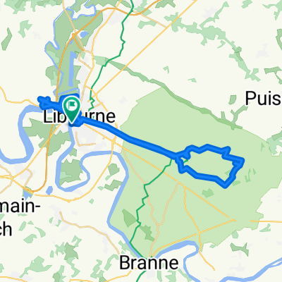
Bx_Perigord-55k
A cycling route starting in Libourne, Nouvelle-Aquitaine, France.
Overview
About this route
- -:--
- Duration
- 53.4 km
- Distance
- 347 m
- Ascent
- 349 m
- Descent
- ---
- Avg. speed
- ---
- Max. altitude

Route quality
Waytypes & surfaces along the route
Waytypes
Quiet road
28.3 km
(53 %)
Road
11.2 km
(21 %)
Surfaces
Paved
34.2 km
(64 %)
Asphalt
34.2 km
(64 %)
Undefined
19.2 km
(36 %)
Continue with Bikemap
Use, edit, or download this cycling route
You would like to ride Bx_Perigord-55k or customize it for your own trip? Here is what you can do with this Bikemap route:
Free features
- Save this route as favorite or in collections
- Copy & plan your own version of this route
- Sync your route with Garmin or Wahoo
Premium features
Free trial for 3 days, or one-time payment. More about Bikemap Premium.
- Navigate this route on iOS & Android
- Export a GPX / KML file of this route
- Create your custom printout (try it for free)
- Download this route for offline navigation
Discover more Premium features.
Get Bikemap PremiumFrom our community
Other popular routes starting in Libourne
 De 30–35 Quai du Priourat, Libourne à 36–39 Quai du Priourat, Libourne
- Distance
- 50.4 km
- Ascent
- 1,766 m
- Descent
- 1,764 m
- Location
- Libourne, Nouvelle-Aquitaine, France
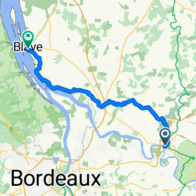 Libourne to Rue Jaufré Rudel, Blaye
- Distance
- 58.8 km
- Ascent
- 419 m
- Descent
- 421 m
- Location
- Libourne, Nouvelle-Aquitaine, France
 PERIGORD - Libourne - Gensac
- Distance
- 56.9 km
- Ascent
- 434 m
- Descent
- 373 m
- Location
- Libourne, Nouvelle-Aquitaine, France
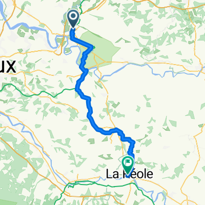 Libourne - La Réole
- Distance
- 61.9 km
- Ascent
- 516 m
- Descent
- 517 m
- Location
- Libourne, Nouvelle-Aquitaine, France
 2021.08.21-22 Libourne - Le Puch - La Sauve - Bordeaux
- Distance
- 69.5 km
- Ascent
- 279 m
- Descent
- 292 m
- Location
- Libourne, Nouvelle-Aquitaine, France
 scandiberique
- Distance
- 1,034.8 km
- Ascent
- 897 m
- Descent
- 828 m
- Location
- Libourne, Nouvelle-Aquitaine, France
 Barail - Ferrand
- Distance
- 9.6 km
- Ascent
- 109 m
- Descent
- 49 m
- Location
- Libourne, Nouvelle-Aquitaine, France
 EFR 105 Libourne Bordeaux kort
- Distance
- 36.7 km
- Ascent
- 227 m
- Descent
- 234 m
- Location
- Libourne, Nouvelle-Aquitaine, France
Open it in the app