

Raabtalradweg
A cycling route starting in Hohenau an der Raab, Styria, Austria.
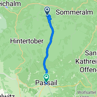
Overview
About this route
You cycle along the Raab, past venerable castles, for 104 km through the Styrian Thermal Region and into Hungary. This cycle path is easy and suitable for the whole family. Along the route, you'll find many family-friendly attractions.
- -:--
- Duration
- 91.5 km
- Distance
- 159 m
- Ascent
- 961 m
- Descent
- ---
- Avg. speed
- ---
- Max. altitude

Continue with Bikemap
Use, edit, or download this cycling route
You would like to ride Raabtalradweg or customize it for your own trip? Here is what you can do with this Bikemap route:
Free features
- Save this route as favorite or in collections
- Copy & plan your own version of this route
- Split it into stages to create a multi-day tour
- Sync your route with Garmin or Wahoo
Premium features
Free trial for 3 days, or one-time payment. More about Bikemap Premium.
- Navigate this route on iOS & Android
- Export a GPX / KML file of this route
- Create your custom printout (try it for free)
- Download this route for offline navigation
Discover more Premium features.
Get Bikemap PremiumFrom our community
Other popular routes starting in Hohenau an der Raab
 R11 Raabtal-Radweg
- Distance
- 121 km
- Ascent
- 705 m
- Descent
- 1,385 m
- Location
- Hohenau an der Raab, Styria, Austria
 RÁBA túra
- Distance
- 285.1 km
- Ascent
- 177 m
- Descent
- 893 m
- Location
- Hohenau an der Raab, Styria, Austria
 r11 rábamenti
- Distance
- 109.2 km
- Ascent
- 713 m
- Descent
- 1,389 m
- Location
- Hohenau an der Raab, Styria, Austria
 Etappe2: Passail nach Sulmsee via R2
- Distance
- 99 km
- Ascent
- 1,220 m
- Descent
- 1,658 m
- Location
- Hohenau an der Raab, Styria, Austria
 Raabtalradweg
- Distance
- 91.5 km
- Ascent
- 159 m
- Descent
- 961 m
- Location
- Hohenau an der Raab, Styria, Austria
 Raabtalradweg
- Distance
- 101.8 km
- Ascent
- 167 m
- Descent
- 1,033 m
- Location
- Hohenau an der Raab, Styria, Austria
 Hohenau 35, Hohenau an der Raab do Széll Kálmán tér 25, Szentgotthárd
- Distance
- 114.1 km
- Ascent
- 2,188 m
- Descent
- 2,882 m
- Location
- Hohenau an der Raab, Styria, Austria
 R11_0
R11_0- Distance
- 8.4 km
- Ascent
- 58 m
- Descent
- 426 m
- Location
- Hohenau an der Raab, Styria, Austria
Open it in the app