TruTour 08.05.2012
- 31.4 km
- 932 m
- 927 m
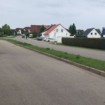
- Aichhalden, Baden-Wurttemberg, Germany
A cycling route starting in Aichhalden, Baden-Wurttemberg, Germany.
Overview
created this 8 years ago
Route quality
Quiet road
28.9 km
(46 %)
Road
13.2 km
(21 %)
Paved
45.8 km
(73 %)
Unpaved
1.9 km
(3 %)
Asphalt
37.7 km
(60 %)
Paved (undefined)
8.2 km
(13 %)
Continue with Bikemap
You would like to ride Wolfach_Fohrenbühl or customize it for your own trip? Here is what you can do with this Bikemap route:
Free trial for 3 days, or one-time payment. More about Bikemap Premium.
Discover more Premium features.
Get Bikemap PremiumFrom our community
Open it in the app