Stevenstour, Nostalgische Kogas, Vechta-Diepholz-Goldenstedt-Langförden
A cycling route starting in Bühren, Lower Saxony, Germany.
Overview
About this route
- 2 h 26 min
- Duration
- 62.1 km
- Distance
- 47 m
- Ascent
- 48 m
- Descent
- 25.6 km/h
- Avg. speed
- ---
- Avg. speed
Route photos
Route quality
Waytypes & surfaces along the route
Waytypes
Quiet road
42.7 km
(69 %)
Path
7.4 km
(12 %)
Surfaces
Paved
44.9 km
(72 %)
Unpaved
0.8 km
(1 %)
Asphalt
43.2 km
(69 %)
Paving stones
0.9 km
(1 %)
Continue with Bikemap
Use, edit, or download this cycling route
You would like to ride Stevenstour, Nostalgische Kogas, Vechta-Diepholz-Goldenstedt-Langförden or customize it for your own trip? Here is what you can do with this Bikemap route:
Free features
- Save this route as favorite or in collections
- Copy & plan your own version of this route
- Sync your route with Garmin or Wahoo
Premium features
Free trial for 3 days, or one-time payment. More about Bikemap Premium.
- Navigate this route on iOS & Android
- Export a GPX / KML file of this route
- Create your custom printout (try it for free)
- Download this route for offline navigation
Discover more Premium features.
Get Bikemap PremiumFrom our community
Other popular routes starting in Bühren
- Lange Straße 1, Vechta nach Lange Straße 1, Vechta
- Distance
- 35.4 km
- Ascent
- 124 m
- Descent
- 125 m
- Location
- Bühren, Lower Saxony, Germany
- AH BVB auf Tour
- Distance
- 38.5 km
- Ascent
- 45 m
- Descent
- 50 m
- Location
- Bühren, Lower Saxony, Germany
- BBB-Tour (Bühren-Bremerhaven-Bühren)
- Distance
- 259.5 km
- Ascent
- 143 m
- Descent
- 143 m
- Location
- Bühren, Lower Saxony, Germany
- Knapp vörbie on Tour
- Distance
- 129.9 km
- Ascent
- 204 m
- Descent
- 204 m
- Location
- Bühren, Lower Saxony, Germany
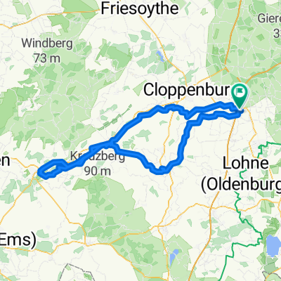
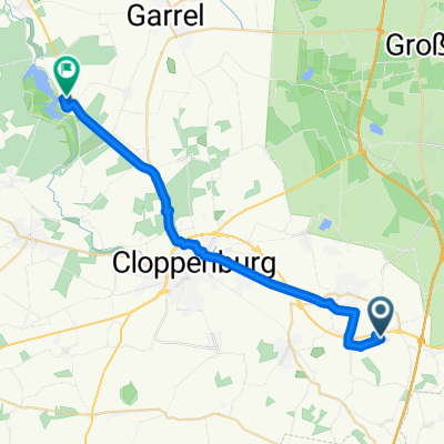
- Bühren-Oldenburg-Bühren
- Distance
- 110.1 km
- Ascent
- 104 m
- Descent
- 104 m
- Location
- Bühren, Lower Saxony, Germany
- Stevenstour, Engelmannsbäke
- Distance
- 41.2 km
- Ascent
- 84 m
- Descent
- 83 m
- Location
- Bühren, Lower Saxony, Germany
- BVB AH auf Abendtour
- Distance
- 40.5 km
- Ascent
- 46 m
- Descent
- 48 m
- Location
- Bühren, Lower Saxony, Germany
- Der Kohlkönig fährt voran.
- Distance
- 65.5 km
- Ascent
- 115 m
- Descent
- 117 m
- Location
- Bühren, Lower Saxony, Germany
Open it in the app