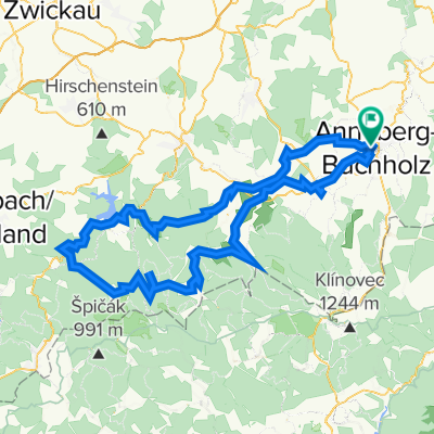
Annaberg Landring-Radeln
A cycling route starting in Annaberg-Buchholz, Saxony, Germany.
Overview
About this route
- 3 h 57 min
 - Duration
 - 63.1 km
 - Distance
 - 936 m
 - Ascent
 - 936 m
 - Descent
 - 16 km/h
 - Avg. speed
 - ---
 - Max. altitude
 
Route quality
Waytypes & surfaces along the route
Waytypes
Track
43.5 km
(69 %)
Quiet road
12 km
(19 %)
Surfaces
Paved
38.5 km
(61 %)
Unpaved
20.2 km
(32 %)
Asphalt
32.8 km
(52 %)
Gravel
16.4 km
(26 %)
Continue with Bikemap
Use, edit, or download this cycling route
You would like to ride Annaberg Landring-Radeln or customize it for your own trip? Here is what you can do with this Bikemap route:
Free features
- Save this route as favorite or in collections
 - Copy & plan your own version of this route
 - Sync your route with Garmin or Wahoo
 
Premium features
Free trial for 3 days, or one-time payment. More about Bikemap Premium.
- Navigate this route on iOS & Android
 - Export a GPX / KML file of this route
 - Create your custom printout (try it for free)
 - Download this route for offline navigation
 
Discover more Premium features.
Get Bikemap PremiumFrom our community
Other popular routes starting in Annaberg-Buchholz
Cranzahl Talsperrentour- Distance
 - 27.5 km
 - Ascent
 - 367 m
 - Descent
 - 383 m
 - Location
 - Annaberg-Buchholz, Saxony, Germany
 
Einmal um Annaberg- Distance
 - 18.8 km
 - Ascent
 - 292 m
 - Descent
 - 371 m
 - Location
 - Annaberg-Buchholz, Saxony, Germany
 
Annaberg - Fichtelberg - Annaberg- Distance
 - 43.2 km
 - Ascent
 - 713 m
 - Descent
 - 669 m
 - Location
 - Annaberg-Buchholz, Saxony, Germany
 
Kleinerzgebirge- Distance
 - 31 km
 - Ascent
 - 477 m
 - Descent
 - 477 m
 - Location
 - Annaberg-Buchholz, Saxony, Germany
 
Fünfhüberltour fürs Rennrad- Distance
 - 113.7 km
 - Ascent
 - 1,914 m
 - Descent
 - 1,910 m
 - Location
 - Annaberg-Buchholz, Saxony, Germany
 
Annaberg - Hammerunterwiesenthal- Distance
 - 37.3 km
 - Ascent
 - 356 m
 - Descent
 - 357 m
 - Location
 - Annaberg-Buchholz, Saxony, Germany
 
Buchholz-Finkenburg-Hemannsdorf-Schlettau-Dörfel-Buchholz- Distance
 - 22.9 km
 - Ascent
 - 501 m
 - Descent
 - 465 m
 - Location
 - Annaberg-Buchholz, Saxony, Germany
 
Annaberg- Fichtelberg- Distance
 - 79.7 km
 - Ascent
 - 1,134 m
 - Descent
 - 1,134 m
 - Location
 - Annaberg-Buchholz, Saxony, Germany
 
Open it in the app


