


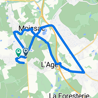
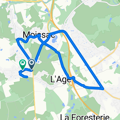
Essai enregistrement de route
A cycling route starting in Condat-sur-Vienne, Nouvelle-Aquitaine, France.
Overview
About this route
1
sur 2 km
- 2 min
- Duration
- 2 km
- Distance
- 15 m
- Ascent
- 44 m
- Descent
- 69.5 km/h
- Avg. speed
- ---
- Max. altitude
Chantal Willems
created this 8 years ago
Route quality
Waytypes & surfaces along the route
Surfaces
Paved
2 km
(100 %)
Asphalt
2 km
100 %
Continue with Bikemap
Use, edit, or download this cycling route
You would like to ride Essai enregistrement de route or customize it for your own trip? Here is what you can do with this Bikemap route:
Free features
- Save this route as favorite or in collections
- Copy & plan your own version of this route
- Sync your route with Garmin or Wahoo
Premium features
Free trial for 3 days, or one-time payment. More about Bikemap Premium.
- Navigate this route on iOS & Android
- Export a GPX / KML file of this route
- Create your custom printout (try it for free)
- Download this route for offline navigation
Discover more Premium features.
Get Bikemap PremiumFrom our community
Other popular routes starting in Condat-sur-Vienne

 De 72 Rue Paul Claudel, Limoges à Léréterie, Saint-Hilaire-Bonneval0
- 16.9 km
- 324 m
- 296 m
- Condat-sur-Vienne, Nouvelle-Aquitaine, France
 De Rue de la Crosse à Rue de la Crosse0
- 10.7 km
- 118 m
- 173 m
- Condat-sur-Vienne, Nouvelle-Aquitaine, France
 От Rue Paul Claudel 40, Limoges до Rue Paul Claudel 40, Limoges0
- 11 km
- 103 m
- 155 m
- Condat-sur-Vienne, Nouvelle-Aquitaine, France

 De Rue de la Crosse à Rue de la Crosse0
- 10.6 km
- 123 m
- 180 m
- Condat-sur-Vienne, Nouvelle-Aquitaine, France
 De 4 Chemin du Picq, Condat-sur-Vienne à 24 Avenue Georges Clemenceau, Feytiat0
- 53.7 km
- 849 m
- 846 m
- Condat-sur-Vienne, Nouvelle-Aquitaine, France


Open it in the app