

Ciclabile Val Lagarina 2017
A cycling route starting in Volargne, Veneto, Italy.
Overview
About this route
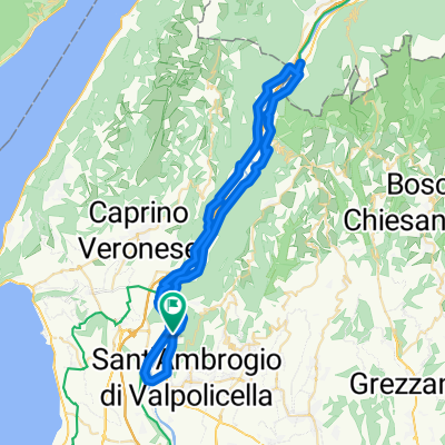
Si sale sulla dx dell'Adige da Ponton e si scende sulla sua riva sinistra tornando al punto di partenza dopo 63 km.
- -:--
- Duration
- 65.9 km
- Distance
- 333 m
- Ascent
- 333 m
- Descent
- ---
- Avg. speed
- ---
- Max. altitude

Route quality
Waytypes & surfaces along the route
Waytypes
Cycleway
32 km
(49 %)
Quiet road
11 km
(17 %)
Surfaces
Paved
55.3 km
(84 %)
Unpaved
0.2 km
(<1 %)
Asphalt
55 km
(84 %)
Loose gravel
0.2 km
(<1 %)
Continue with Bikemap
Use, edit, or download this cycling route
You would like to ride Ciclabile Val Lagarina 2017 or customize it for your own trip? Here is what you can do with this Bikemap route:
Free features
- Save this route as favorite or in collections
- Copy & plan your own version of this route
- Sync your route with Garmin or Wahoo
Premium features
Free trial for 3 days, or one-time payment. More about Bikemap Premium.
- Navigate this route on iOS & Android
- Export a GPX / KML file of this route
- Create your custom printout (try it for free)
- Download this route for offline navigation
Discover more Premium features.
Get Bikemap PremiumFrom our community
Other popular routes starting in Volargne
 05_Gaium-Verona
- Distance
- 25.2 km
- Ascent
- 114 m
- Descent
- 180 m
- Location
- Volargne, Veneto, Italy
 Rivoli-Trento-Bassane del Grappa-Vicence
- Distance
- 449 km
- Ascent
- 3,032 m
- Descent
- 3,032 m
- Location
- Volargne, Veneto, Italy
 Da Via Menego 478, Colombare a Via San Martino 85, Colombare
- Distance
- 61.3 km
- Ascent
- 225 m
- Descent
- 304 m
- Location
- Volargne, Veneto, Italy
 SVDF
SVDF- Distance
- 158.1 km
- Ascent
- 1,676 m
- Descent
- 367 m
- Location
- Volargne, Veneto, Italy
 Val del Tasso - M.te Moscal
- Distance
- 22.6 km
- Ascent
- 265 m
- Descent
- 266 m
- Location
- Volargne, Veneto, Italy
 Giro bici val d'adige
- Distance
- 28.5 km
- Ascent
- 149 m
- Descent
- 115 m
- Location
- Volargne, Veneto, Italy
 Ciclabile Val Lagarina 2017
- Distance
- 65.9 km
- Ascent
- 333 m
- Descent
- 333 m
- Location
- Volargne, Veneto, Italy
 Forte Masua - Dolce
- Distance
- 52.6 km
- Ascent
- 1,121 m
- Descent
- 1,093 m
- Location
- Volargne, Veneto, Italy
Open it in the app