

Nasbidaniel1
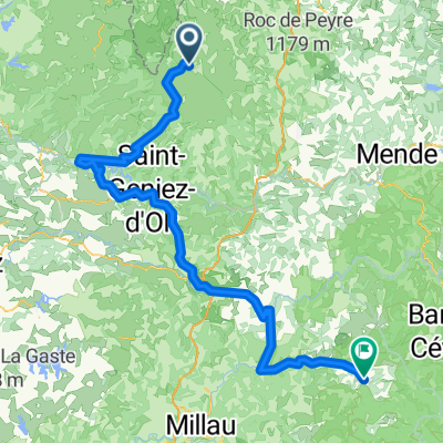
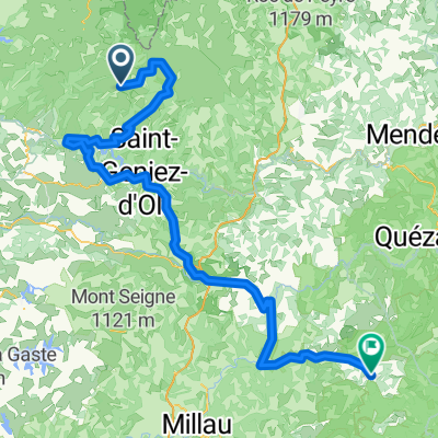
A cycling route starting in Laguiole, Occitanie, France.
Overview
About this route
- -:--
- Duration
- 53.4 km
- Distance
- 964 m
- Ascent
- 964 m
- Descent
- ---
- Avg. speed
- ---
- Max. altitude
Route quality
Waytypes & surfaces along the route
Waytypes
Road
21.9 km
(41 %)
Quiet road
1.1 km
(2 %)
Surfaces
Paved
21.3 km
(40 %)
Asphalt
21.3 km
(40 %)
Undefined
32 km
(60 %)
Continue with Bikemap
Use, edit, or download this cycling route
You would like to ride Nasbidaniel1 or customize it for your own trip? Here is what you can do with this Bikemap route:
Free features
- Save this route as favorite or in collections
- Copy & plan your own version of this route
- Sync your route with Garmin or Wahoo
Premium features
Free trial for 3 days, or one-time payment. More about Bikemap Premium.
- Navigate this route on iOS & Android
- Export a GPX / KML file of this route
- Create your custom printout (try it for free)
- Download this route for offline navigation
Discover more Premium features.
Get Bikemap PremiumFrom our community
Other popular routes starting in Laguiole
 2014 Ride Day 99 - St-Chély-d'Aubrac to Marvejols
- Distance
- 44.7 km
- Ascent
- 673 m
- Descent
- 856 m
- Location
- Laguiole, Occitanie, France
 JATIENZA2
- Distance
- 44.1 km
- Ascent
- 860 m
- Descent
- 858 m
- Location
- Laguiole, Occitanie, France
 Route de Sainte-Urcize 21, Nasbinals nach Avenue Albert Thomas 23, Capdenac-Gare
- Distance
- 114 km
- Ascent
- 2,345 m
- Descent
- 3,338 m
- Location
- Laguiole, Occitanie, France
 étape 5
- Distance
- 105 km
- Ascent
- 1,228 m
- Descent
- 1,265 m
- Location
- Laguiole, Occitanie, France
 Aveyron-Tag1--4-0719 Runde angepasst 2
- Distance
- 138.5 km
- Ascent
- 1,438 m
- Descent
- 1,922 m
- Location
- Laguiole, Occitanie, France
 Aveyron-Tag1--4-0719 Runde angepasst
- Distance
- 142.3 km
- Ascent
- 1,759 m
- Descent
- 1,875 m
- Location
- Laguiole, Occitanie, France
 Ride Day 32—13 Oct 2005—48260 Recoules D'Aubrac (Nasbinals) to 15300 Murat
- Distance
- 67.6 km
- Ascent
- 587 m
- Descent
- 757 m
- Location
- Laguiole, Occitanie, France
 09-MassifCentral
- Distance
- 60.8 km
- Ascent
- 509 m
- Descent
- 1,057 m
- Location
- Laguiole, Occitanie, France
Open it in the app