

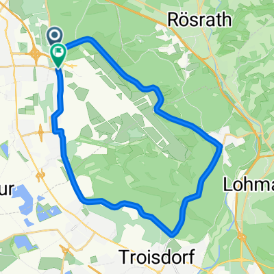
Eil - Troisdorf - Altenrath - (Flughafen) - Eil
A cycling route starting in Eil, North Rhine-Westphalia, Germany.
Overview
About this route
There isn't much to write about. The route is flat, 100% paved, and has few annoying traffic lights.
Have fun wishes the amateur cyclist
- -:--
- Duration
- 32.5 km
- Distance
- 127 m
- Ascent
- 118 m
- Descent
- ---
- Avg. speed
- 125 m
- Max. altitude

Route quality
Waytypes & surfaces along the route
Waytypes
Road
9.8 km
(30 %)
Quiet road
4.9 km
(15 %)
Surfaces
Paved
30.6 km
(94 %)
Unpaved
1 km
(3 %)
Asphalt
28 km
(86 %)
Concrete
2 km
(6 %)
Continue with Bikemap
Use, edit, or download this cycling route
You would like to ride Eil - Troisdorf - Altenrath - (Flughafen) - Eil or customize it for your own trip? Here is what you can do with this Bikemap route:
Free features
- Save this route as favorite or in collections
- Copy & plan your own version of this route
- Sync your route with Garmin or Wahoo
Premium features
Free trial for 3 days, or one-time payment. More about Bikemap Premium.
- Navigate this route on iOS & Android
- Export a GPX / KML file of this route
- Create your custom printout (try it for free)
- Download this route for offline navigation
Discover more Premium features.
Get Bikemap PremiumFrom our community
Other popular routes starting in Eil
 Porz Eil Wahner Heide - Wahnbachtalsperre
- Distance
- 20.9 km
- Ascent
- 242 m
- Descent
- 158 m
- Location
- Eil, North Rhine-Westphalia, Germany
 MTB Königsforst vom 22.11.2009
- Distance
- 33.9 km
- Ascent
- 284 m
- Descent
- 284 m
- Location
- Eil, North Rhine-Westphalia, Germany
 2021 05 Porz - Rolandseck - Rheingold - Porz
- Distance
- 81.9 km
- Ascent
- 515 m
- Descent
- 510 m
- Location
- Eil, North Rhine-Westphalia, Germany
 Flughafenrunde ab Grengel
- Distance
- 22 km
- Ascent
- 120 m
- Descent
- 127 m
- Location
- Eil, North Rhine-Westphalia, Germany
 MTB-Training vom 24.01.2010
- Distance
- 36 km
- Ascent
- 331 m
- Descent
- 330 m
- Location
- Eil, North Rhine-Westphalia, Germany
 2021 04 Porz - Königsforst - Hasbach - Lohmar - Inger-Birk - Wahnbachtalsperre und an der Sieg zurück
- Distance
- 73.7 km
- Ascent
- 818 m
- Descent
- 827 m
- Location
- Eil, North Rhine-Westphalia, Germany
 Im Bergischen Land
- Distance
- 54.8 km
- Ascent
- 550 m
- Descent
- 553 m
- Location
- Eil, North Rhine-Westphalia, Germany
 MTB Königsforst vom 22.11.2009
- Distance
- 33.9 km
- Ascent
- 283 m
- Descent
- 285 m
- Location
- Eil, North Rhine-Westphalia, Germany
Open it in the app