

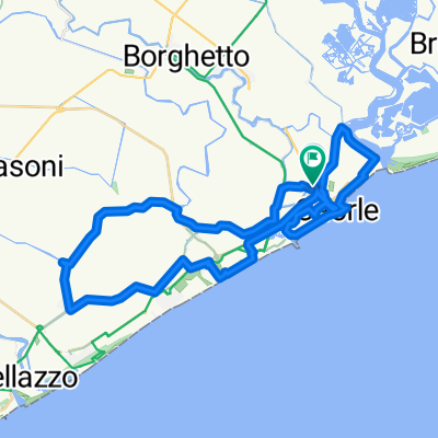
Caorle 2
A cycling route starting in Caorle, Veneto, Italy.
Overview
About this route
- -:--
- Duration
- 54.3 km
- Distance
- 14 m
- Ascent
- 14 m
- Descent
- ---
- Avg. speed
- ---
- Max. altitude

Route quality
Waytypes & surfaces along the route
Waytypes
Quiet road
17.6 km
(32 %)
Busy road
15.6 km
(29 %)
Surfaces
Paved
36.7 km
(68 %)
Unpaved
3.5 km
(6 %)
Asphalt
35.8 km
(66 %)
Unpaved (undefined)
2.4 km
(4 %)
Continue with Bikemap
Use, edit, or download this cycling route
You would like to ride Caorle 2 or customize it for your own trip? Here is what you can do with this Bikemap route:
Free features
- Save this route as favorite or in collections
- Copy & plan your own version of this route
- Sync your route with Garmin or Wahoo
Premium features
Free trial for 3 days, or one-time payment. More about Bikemap Premium.
- Navigate this route on iOS & Android
- Export a GPX / KML file of this route
- Create your custom printout (try it for free)
- Download this route for offline navigation
Discover more Premium features.
Get Bikemap PremiumFrom our community
Other popular routes starting in Caorle
 Caorle 2
- Distance
- 54.3 km
- Ascent
- 14 m
- Descent
- 14 m
- Location
- Caorle, Veneto, Italy
 Caorle-Cavalino
- Distance
- 39.1 km
- Ascent
- 26 m
- Descent
- 22 m
- Location
- Caorle, Veneto, Italy
 Rundfahrt Caorle
- Distance
- 32.9 km
- Ascent
- 17 m
- Descent
- 17 m
- Location
- Caorle, Veneto, Italy
 la barena
- Distance
- 29.3 km
- Ascent
- 63 m
- Descent
- 67 m
- Location
- Caorle, Veneto, Italy
 Altanea-San Dona
- Distance
- 89.8 km
- Ascent
- 47 m
- Descent
- 49 m
- Location
- Caorle, Veneto, Italy
 Venice 2020 Thursday 21 May
- Distance
- 100.4 km
- Ascent
- 13 m
- Descent
- 9 m
- Location
- Caorle, Veneto, Italy
 eraclea1
- Distance
- 45.2 km
- Ascent
- 6 m
- Descent
- 6 m
- Location
- Caorle, Veneto, Italy
 PortoSM - Giretto in Laguna
- Distance
- 102.4 km
- Ascent
- 11 m
- Descent
- 12 m
- Location
- Caorle, Veneto, Italy
Open it in the app