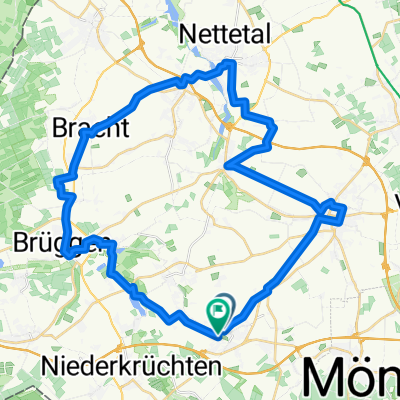
Rundroute
H 63,7 -fitschH.-lobber.-h
A cycling route starting in Schwalmtal, North Rhine-Westphalia, Germany.
Overview
About this route
start/ziel parkplatz MG, brahmsstr./jugendherberge. Rast bei wachtendonk, fitscheshof o. kälberstall - sassenfeld am ferkensbruch.
- -:--
- Duration
- 63.7 km
- Distance
- 101 m
- Ascent
- 101 m
- Descent
- ---
- Avg. speed
- ---
- Max. altitude
Part of
Rundroute
9 stages
Route quality
Waytypes & surfaces along the route
Waytypes
Quiet road
36.7 km
(58 %)
Path
11.2 km
(18 %)
Surfaces
Paved
43.3 km
(68 %)
Unpaved
7.3 km
(11 %)
Asphalt
35.9 km
(56 %)
Gravel
4.9 km
(8 %)
Continue with Bikemap
Use, edit, or download this cycling route
You would like to ride H 63,7 -fitschH.-lobber.-h or customize it for your own trip? Here is what you can do with this Bikemap route:
Free features
- Save this route as favorite or in collections
- Copy & plan your own version of this route
- Sync your route with Garmin or Wahoo
Premium features
Free trial for 3 days, or one-time payment. More about Bikemap Premium.
- Navigate this route on iOS & Android
- Export a GPX / KML file of this route
- Create your custom printout (try it for free)
- Download this route for offline navigation
Discover more Premium features.
Get Bikemap PremiumFrom our community
Other popular routes starting in Schwalmtal
- H51,8 -holtM.-gitstM-6Eich-cafeB.-h
- Distance
- 51.8 km
- Ascent
- 148 m
- Descent
- 151 m
- Location
- Schwalmtal, North Rhine-Westphalia, Germany
- Waldniel-Dülken-Lobberich-Brüggen Rundkurs
- Distance
- 42.3 km
- Ascent
- 151 m
- Descent
- 149 m
- Location
- Schwalmtal, North Rhine-Westphalia, Germany
- Rundweg Schwalmtal
- Distance
- 21.1 km
- Ascent
- 112 m
- Descent
- 111 m
- Location
- Schwalmtal, North Rhine-Westphalia, Germany
- Schwalmroute
- Distance
- 29.7 km
- Ascent
- 65 m
- Descent
- 66 m
- Location
- Schwalmtal, North Rhine-Westphalia, Germany
- Waldniel-Rheindalen
- Distance
- 40.6 km
- Ascent
- 68 m
- Descent
- 69 m
- Location
- Schwalmtal, North Rhine-Westphalia, Germany
- 46,3 h-6eich.-heideBl.-meliM-Okr.-C.B.-h
- Distance
- 46.3 km
- Ascent
- 141 m
- Descent
- 141 m
- Location
- Schwalmtal, North Rhine-Westphalia, Germany
- RTFSchwalmtal-Waldniel 70km-Runde
- Distance
- 70.1 km
- Ascent
- 182 m
- Descent
- 189 m
- Location
- Schwalmtal, North Rhine-Westphalia, Germany
- H 43,8 - wegB.- rotenB.-cafeB.-H
- Distance
- 43.8 km
- Ascent
- 149 m
- Descent
- 147 m
- Location
- Schwalmtal, North Rhine-Westphalia, Germany
Open it in the app