

2018 BIG Day 1/1
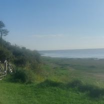
A cycling route starting in Grange-over-Sands, England, United Kingdom.
Overview
About this route
1. Wrynose Pass
2. Hard Knott Pass
3. Kirkstone Pass
- -:--
- Duration
- 85.5 km
- Distance
- 1,263 m
- Ascent
- 1,259 m
- Descent
- ---
- Avg. speed
- ---
- Max. altitude

Route quality
Waytypes & surfaces along the route
Waytypes
Road
29.1 km
(34 %)
Quiet road
17.1 km
(20 %)
Surfaces
Paved
41.9 km
(49 %)
Unpaved
1.7 km
(2 %)
Asphalt
41.9 km
(49 %)
Gravel
1.7 km
(2 %)
Undefined
41.9 km
(49 %)
Route highlights
Points of interest along the route
Point of interest after 30.9 km
Wrynose Pass ENGLAND BIG: 82 Zone: 2 Altitude: 393
Point of interest after 37.3 km
Honister Pass ENGLAND BIG: 80 Zone: 2 Altitude: 362
Point of interest after 37.3 km
Whinlatter Pass ENGLAND BIG: 79 Zone: 2 Altitude: 342
Point of interest after 37.5 km
Hard Knott Pass ENGLAND BIG: 81 Zone: 2 Altitude: 393
Point of interest after 63 km
Kirkstone Pass ENGLAND BIG: 83 Zone: 2 Altitude: 454
Continue with Bikemap
Use, edit, or download this cycling route
You would like to ride 2018 BIG Day 1/1 or customize it for your own trip? Here is what you can do with this Bikemap route:
Free features
- Save this route as favorite or in collections
- Copy & plan your own version of this route
- Split it into stages to create a multi-day tour
- Sync your route with Garmin or Wahoo
Premium features
Free trial for 3 days, or one-time payment. More about Bikemap Premium.
- Navigate this route on iOS & Android
- Export a GPX / KML file of this route
- Create your custom printout (try it for free)
- Download this route for offline navigation
Discover more Premium features.
Get Bikemap PremiumFrom our community
Other popular routes starting in Grange-over-Sands
 16-4- 28 training ride Grizeley
- Distance
- 58 km
- Ascent
- 609 m
- Descent
- 607 m
- Location
- Grange-over-Sands, England, United Kingdom
 Henry evening ride training
- Distance
- 18.6 km
- Ascent
- 279 m
- Descent
- 284 m
- Location
- Grange-over-Sands, England, United Kingdom
 2018 BIG Day 1/1
- Distance
- 85.5 km
- Ascent
- 1,263 m
- Descent
- 1,259 m
- Location
- Grange-over-Sands, England, United Kingdom
 bridle path cartmel route 12miles
- Distance
- 20.2 km
- Ascent
- 382 m
- Descent
- 362 m
- Location
- Grange-over-Sands, England, United Kingdom
 Coast to Coast
- Distance
- 265.2 km
- Ascent
- 3,015 m
- Descent
- 2,962 m
- Location
- Grange-over-Sands, England, United Kingdom
 bridle ways test cartmel 16miles
- Distance
- 30.8 km
- Ascent
- 456 m
- Descent
- 456 m
- Location
- Grange-over-Sands, England, United Kingdom
 28 mile practice route
- Distance
- 45.6 km
- Ascent
- 396 m
- Descent
- 395 m
- Location
- Grange-over-Sands, England, United Kingdom
3843®
Bay Cycle Way- Distance
- 35.7 km
- Ascent
- 226 m
- Descent
- 217 m
- Location
- Grange-over-Sands, England, United Kingdom
Open it in the app