Giro del Pasubio sud
A cycling route starting in Monte di Malo, Veneto, Italy.
Overview
About this route
- -:--
- Duration
- 63.5 km
- Distance
- 1,586 m
- Ascent
- 1,585 m
- Descent
- ---
- Avg. speed
- ---
- Avg. speed
Route quality
Waytypes & surfaces along the route
Waytypes
Road
25.1 km
(40 %)
Track
16.1 km
(25 %)
Surfaces
Paved
29.4 km
(46 %)
Unpaved
17.3 km
(27 %)
Asphalt
29.4 km
(46 %)
Gravel
7.8 km
(12 %)
Continue with Bikemap
Use, edit, or download this cycling route
You would like to ride Giro del Pasubio sud or customize it for your own trip? Here is what you can do with this Bikemap route:
Free features
- Save this route as favorite or in collections
- Copy & plan your own version of this route
- Sync your route with Garmin or Wahoo
Premium features
Free trial for 3 days, or one-time payment. More about Bikemap Premium.
- Navigate this route on iOS & Android
- Export a GPX / KML file of this route
- Create your custom printout (try it for free)
- Download this route for offline navigation
Discover more Premium features.
Get Bikemap PremiumFrom our community
Other popular routes starting in Monte di Malo
- Priabona - Civillina
- Distance
- 38.2 km
- Ascent
- 721 m
- Descent
- 715 m
- Location
- Monte di Malo, Veneto, Italy
- Da Via Scortegagna 2, Monte Magrè a Via Frate Giovanni da Schio 19–35, Schio
- Distance
- 62.5 km
- Ascent
- 1,743 m
- Descent
- 1,941 m
- Location
- Monte di Malo, Veneto, Italy
- Faedo - Verlaldo
- Distance
- 2.9 km
- Ascent
- 85 m
- Descent
- 112 m
- Location
- Monte di Malo, Veneto, Italy
- Giro del Pasubio sud
- Distance
- 63.5 km
- Ascent
- 1,586 m
- Descent
- 1,585 m
- Location
- Monte di Malo, Veneto, Italy
- monte malo
- Distance
- 32.1 km
- Ascent
- 2,467 m
- Descent
- 2,468 m
- Location
- Monte di Malo, Veneto, Italy
- Piazza Montanaro, Monte di Malo a Pesaro
- Distance
- 373.5 km
- Ascent
- 627 m
- Descent
- 993 m
- Location
- Monte di Malo, Veneto, Italy
- Long bike tour through Schio
- Distance
- 75 km
- Ascent
- 1,578 m
- Descent
- 1,578 m
- Location
- Monte di Malo, Veneto, Italy
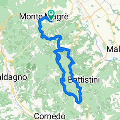
- Restful route in Thiene
- Distance
- 47.2 km
- Ascent
- 1,154 m
- Descent
- 1,306 m
- Location
- Monte di Malo, Veneto, Italy
Open it in the app