Céret–Oms–Castelnou–Thuir–Fourques-Céret
A cycling route starting in Ceret, Languedoc-Roussillon-Midi-Pyrénées, France.
Overview
About this route
- -:--
- Duration
- 61 km
- Distance
- 971 m
- Ascent
- 961 m
- Descent
- ---
- Avg. speed
- ---
- Avg. speed
Route quality
Waytypes & surfaces along the route
Waytypes
Busy road
28.9 km
(47 %)
Road
20.7 km
(34 %)
Surfaces
Paved
39.8 km
(65 %)
Unpaved
6.1 km
(10 %)
Asphalt
39.5 km
(65 %)
Gravel
5.5 km
(9 %)
Continue with Bikemap
Use, edit, or download this cycling route
You would like to ride Céret–Oms–Castelnou–Thuir–Fourques-Céret or customize it for your own trip? Here is what you can do with this Bikemap route:
Free features
- Save this route as favorite or in collections
- Copy & plan your own version of this route
- Sync your route with Garmin or Wahoo
Premium features
Free trial for 3 days, or one-time payment. More about Bikemap Premium.
- Navigate this route on iOS & Android
- Export a GPX / KML file of this route
- Create your custom printout (try it for free)
- Download this route for offline navigation
Discover more Premium features.
Get Bikemap PremiumFrom our community
Other popular routes starting in Ceret
- font frede CLONED FROM ROUTE 1161710
- Distance
- 42.4 km
- Ascent
- 1,048 m
- Descent
- 1,044 m
- Location
- Ceret, Languedoc-Roussillon-Midi-Pyrénées, France
- puig forcat, via het dorpje Les Illas
- Distance
- 41.2 km
- Ascent
- 1,013 m
- Descent
- 1,018 m
- Location
- Ceret, Languedoc-Roussillon-Midi-Pyrénées, France
- Nice tour starting in Ceret
- Distance
- 27.7 km
- Ascent
- 515 m
- Descent
- 515 m
- Location
- Ceret, Languedoc-Roussillon-Midi-Pyrénées, France
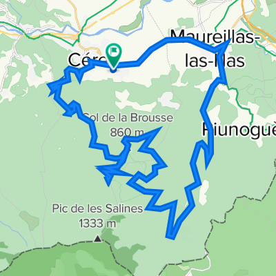
- Céret-Oms-Col de Fourtou-Montauriol-Fourques-Céret
- Distance
- 50.2 km
- Ascent
- 848 m
- Descent
- 838 m
- Location
- Ceret, Languedoc-Roussillon-Midi-Pyrénées, France
- 2013 Ride Day 6 - Céret Circle
- Distance
- 67.6 km
- Ascent
- 1,119 m
- Descent
- 1,119 m
- Location
- Ceret, Languedoc-Roussillon-Midi-Pyrénées, France
- 2008-08---rundtour las illas, coustouges, amelie etc
- Distance
- 87.9 km
- Ascent
- 1,400 m
- Descent
- 1,400 m
- Location
- Ceret, Languedoc-Roussillon-Midi-Pyrénées, France
- Céret–Oms–Castelnou–Thuir–Fourques-Céret
- Distance
- 61 km
- Ascent
- 971 m
- Descent
- 961 m
- Location
- Ceret, Languedoc-Roussillon-Midi-Pyrénées, France
- Céret-Oms-Col de Fourtou-Amélie-Céret
- Distance
- 48.8 km
- Ascent
- 875 m
- Descent
- 889 m
- Location
- Ceret, Languedoc-Roussillon-Midi-Pyrénées, France
Open it in the app