

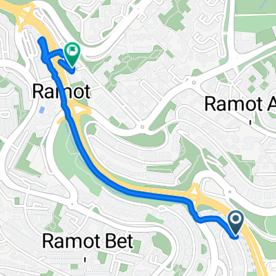
יגאל אלון לקניון רמות
A cycling route starting in Bayt Iksā, West Bank, Palestine.
Overview
About this route
- -:--
- Duration
- 1.6 km
- Distance
- 104 m
- Ascent
- 20 m
- Descent
- ---
- Avg. speed
- ---
- Max. altitude

Continue with Bikemap
Use, edit, or download this cycling route
You would like to ride יגאל אלון לקניון רמות or customize it for your own trip? Here is what you can do with this Bikemap route:
Free features
- Save this route as favorite or in collections
- Copy & plan your own version of this route
- Sync your route with Garmin or Wahoo
Premium features
Free trial for 3 days, or one-time payment. More about Bikemap Premium.
- Navigate this route on iOS & Android
- Export a GPX / KML file of this route
- Create your custom printout (try it for free)
- Download this route for offline navigation
Discover more Premium features.
Get Bikemap PremiumFrom our community
Other popular routes starting in Bayt Iksā
 test
test- Distance
- 0.3 km
- Ascent
- 0 m
- Descent
- 0 m
- Location
- Bayt Iksā, West Bank, Palestine
 Quick ride from (null) to (null)
- Distance
- 0.7 km
- Ascent
- 21 m
- Descent
- 21 m
- Location
- Bayt Iksā, West Bank, Palestine
 Jerusalem - Tzuba - Latrun
- Distance
- 107.3 km
- Ascent
- 3,196 m
- Descent
- 3,198 m
- Location
- Bayt Iksā, West Bank, Palestine
 1 الطريق السريع رقم, القدس to 2 شارع ابن جبير, الشيخ جراح
- Distance
- 6.5 km
- Ascent
- 226 m
- Descent
- 92 m
- Location
- Bayt Iksā, West Bank, Palestine
 Mevaseret Har Hadar
- Distance
- 15.7 km
- Ascent
- 455 m
- Descent
- 434 m
- Location
- Bayt Iksā, West Bank, Palestine
 עין כרם
- Distance
- 50.5 km
- Ascent
- 955 m
- Descent
- 847 m
- Location
- Bayt Iksā, West Bank, Palestine
 Steady rideאטינגר
- Distance
- 8.6 km
- Ascent
- 171 m
- Descent
- 196 m
- Location
- Bayt Iksā, West Bank, Palestine
 יגאל אלון לקניון רמות
- Distance
- 1.6 km
- Ascent
- 104 m
- Descent
- 20 m
- Location
- Bayt Iksā, West Bank, Palestine
Open it in the app