

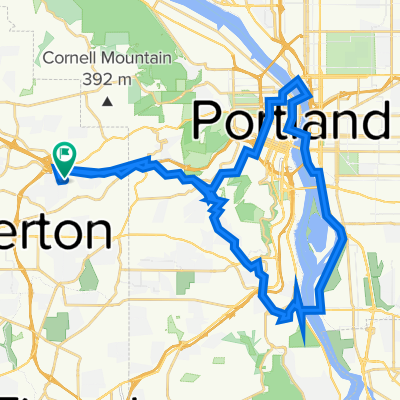
Brief bike tour to Library
A cycling route starting in West Slope, Oregon, United States.
Overview
About this route
- 1 h 28 min
- Duration
- 1.8 km
- Distance
- 8 m
- Ascent
- 8 m
- Descent
- 1.2 km/h
- Avg. speed
- ---
- Max. altitude

Route quality
Waytypes & surfaces along the route
Waytypes
Quiet road
1.5 km
(83 %)
Pedestrian area
0.1 km
(7 %)
Surfaces
Paved
1.4 km
(79 %)
Asphalt
1.3 km
(71 %)
Paved (undefined)
0.1 km
(4 %)
Route highlights
Points of interest along the route
Point of interest after 1.8 km
library
Continue with Bikemap
Use, edit, or download this cycling route
You would like to ride Brief bike tour to Library or customize it for your own trip? Here is what you can do with this Bikemap route:
Free features
- Save this route as favorite or in collections
- Copy & plan your own version of this route
- Sync your route with Garmin or Wahoo
Premium features
Free trial for 3 days, or one-time payment. More about Bikemap Premium.
- Navigate this route on iOS & Android
- Export a GPX / KML file of this route
- Create your custom printout (try it for free)
- Download this route for offline navigation
Discover more Premium features.
Get Bikemap PremiumFrom our community
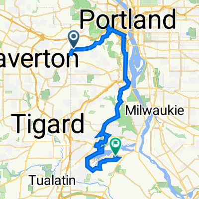
Other popular routes starting in West Slope
 Moderate route in Beaverton
- Distance
- 4.9 km
- Ascent
- 0 m
- Descent
- 122 m
- Location
- West Slope, Oregon, United States
 Route from Southwest 102nd Avenue 3950, Beaverton
- Distance
- 5.6 km
- Ascent
- 90 m
- Descent
- 52 m
- Location
- West Slope, Oregon, United States
 trek bike
- Distance
- 5.4 km
- Ascent
- 6 m
- Descent
- 153 m
- Location
- West Slope, Oregon, United States
 Home/CC Steel B/ Sellwood B/ Wilson High/CC/Home
- Distance
- 39.5 km
- Ascent
- 578 m
- Descent
- 576 m
- Location
- West Slope, Oregon, United States
 St. John’s
- Distance
- 39.6 km
- Ascent
- 733 m
- Descent
- 733 m
- Location
- West Slope, Oregon, United States
 Home/CC/Steel B/Sellwood B/ CC/Home
- Distance
- 40.1 km
- Ascent
- 575 m
- Descent
- 574 m
- Location
- West Slope, Oregon, United States
 Raleigh Hills to LO
- Distance
- 30.3 km
- Ascent
- 682 m
- Descent
- 680 m
- Location
- West Slope, Oregon, United States
 Moderate route in West Haven
- Distance
- 0.4 km
- Ascent
- 9 m
- Descent
- 18 m
- Location
- West Slope, Oregon, United States
Open it in the app