

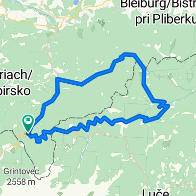
Turnersee-Seebergsattel-Paulitsch
A cycling route starting in Bad Eisenkappel, Carinthia, Austria.
Overview
About this route
- -:--
- Duration
- 116.6 km
- Distance
- 1,821 m
- Ascent
- 1,830 m
- Descent
- ---
- Avg. speed
- ---
- Max. altitude
Route quality
Waytypes & surfaces along the route
Waytypes
Road
35 km
(30 %)
Quiet road
7 km
(6 %)
Undefined
74.6 km
(64 %)
Surfaces
Paved
80.5 km
(69 %)
Asphalt
80.5 km
(69 %)
Undefined
36.2 km
(31 %)
Continue with Bikemap
Use, edit, or download this cycling route
You would like to ride Turnersee-Seebergsattel-Paulitsch or customize it for your own trip? Here is what you can do with this Bikemap route:
Free features
- Save this route as favorite or in collections
- Copy & plan your own version of this route
- Split it into stages to create a multi-day tour
- Sync your route with Garmin or Wahoo
Premium features
Free trial for 3 days, or one-time payment. More about Bikemap Premium.
- Navigate this route on iOS & Android
- Export a GPX / KML file of this route
- Create your custom printout (try it for free)
- Download this route for offline navigation
Discover more Premium features.
Get Bikemap PremiumFrom our community
Other popular routes starting in Bad Eisenkappel
 Hochobir Bike n' Hike
- Distance
- 15.1 km
- Ascent
- 1,651 m
- Descent
- 170 m
- Location
- Bad Eisenkappel, Carinthia, Austria
 Smart Čezmejni Železna kapla - Pavličevo sedlo
- Distance
- 61.1 km
- Ascent
- 1,587 m
- Descent
- 1,565 m
- Location
- Bad Eisenkappel, Carinthia, Austria
 vzpon na Pavlicevo Sedlo
- Distance
- 7.4 km
- Ascent
- 662 m
- Descent
- 207 m
- Location
- Bad Eisenkappel, Carinthia, Austria
 bad eisenkappel
- Distance
- 135.9 km
- Ascent
- 788 m
- Descent
- 798 m
- Location
- Bad Eisenkappel, Carinthia, Austria
 Koroska-panoramska
- Distance
- 62.6 km
- Ascent
- 3,531 m
- Descent
- 3,531 m
- Location
- Bad Eisenkappel, Carinthia, Austria
 Paulitsch- u. Seebergsattel
- Distance
- 59.2 km
- Ascent
- 3,080 m
- Descent
- 3,083 m
- Location
- Bad Eisenkappel, Carinthia, Austria
 Vellach 9 nach Vellach 9
- Distance
- 20.9 km
- Ascent
- 695 m
- Descent
- 677 m
- Location
- Bad Eisenkappel, Carinthia, Austria
 Bad Eisekpappel_Luschalalm_Paulitsch
- Distance
- 57.7 km
- Ascent
- 1,577 m
- Descent
- 1,577 m
- Location
- Bad Eisenkappel, Carinthia, Austria
Open it in the app