

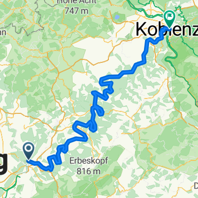
Radtour Trier - Koblenz
A cycling route starting in Kenn, Rhineland-Palatinate, Germany.
Overview
About this route
From 25.08 to 28.08, I cycled from Trier to Koblenz. At the beginning, I would rather switch to the right bank of the Moselle from Trier Pfalzel right away instead of staying on the left side as here. Furthermore, I would no longer follow the advice of a local and from Cochem ride right of the Moselle through the protected area of Pommernheld - the paths there are quite bumpy and therefore poorly suited for cycling. So it's better to stay on the Moselle bike path on the left side of the Moselle. Otherwise, the route mostly follows bike paths along the Moselle.
- -:--
- Duration
- 185.6 km
- Distance
- 219 m
- Ascent
- 275 m
- Descent
- ---
- Avg. speed
- ---
- Max. altitude

Route photos


Route quality
Waytypes & surfaces along the route
Waytypes
Path
72.4 km
(39 %)
Track
35.3 km
(19 %)
Surfaces
Paved
154 km
(83 %)
Unpaved
5.6 km
(3 %)
Asphalt
150.3 km
(81 %)
Paved (undefined)
3.7 km
(2 %)
Continue with Bikemap
Use, edit, or download this cycling route
You would like to ride Radtour Trier - Koblenz or customize it for your own trip? Here is what you can do with this Bikemap route:
Free features
- Save this route as favorite or in collections
- Copy & plan your own version of this route
- Split it into stages to create a multi-day tour
- Sync your route with Garmin or Wahoo
Premium features
Free trial for 3 days, or one-time payment. More about Bikemap Premium.
- Navigate this route on iOS & Android
- Export a GPX / KML file of this route
- Create your custom printout (try it for free)
- Download this route for offline navigation
Discover more Premium features.
Get Bikemap PremiumFrom our community
Other popular routes starting in Kenn
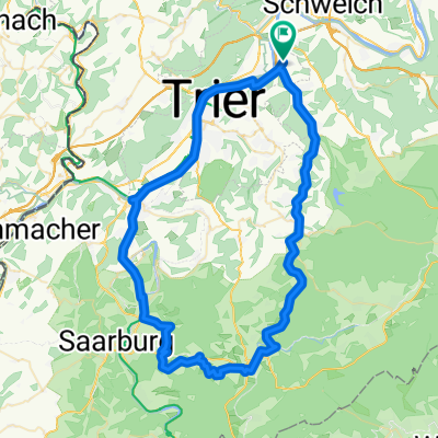
 Ausfahrt durch Trier
- Distance
- 26.2 km
- Ascent
- 219 m
- Descent
- 215 m
- Location
- Kenn, Rhineland-Palatinate, Germany
 Radtour Trier - Koblenz
- Distance
- 185.6 km
- Ascent
- 219 m
- Descent
- 275 m
- Location
- Kenn, Rhineland-Palatinate, Germany
 Unbenannte Route
- Distance
- 240.4 km
- Ascent
- 3,177 m
- Descent
- 3,175 m
- Location
- Kenn, Rhineland-Palatinate, Germany
 Lange Ausfahrt durch Trier
- Distance
- 70.2 km
- Ascent
- 503 m
- Descent
- 503 m
- Location
- Kenn, Rhineland-Palatinate, Germany
 Graveltour Mosel
- Distance
- 65.9 km
- Ascent
- 947 m
- Descent
- 948 m
- Location
- Kenn, Rhineland-Palatinate, Germany
 Kylltalradweg Eifel
- Distance
- 116.2 km
- Ascent
- 898 m
- Descent
- 356 m
- Location
- Kenn, Rhineland-Palatinate, Germany
 Trier-Koblenz
- Distance
- 184.5 km
- Ascent
- 1,679 m
- Descent
- 1,766 m
- Location
- Kenn, Rhineland-Palatinate, Germany
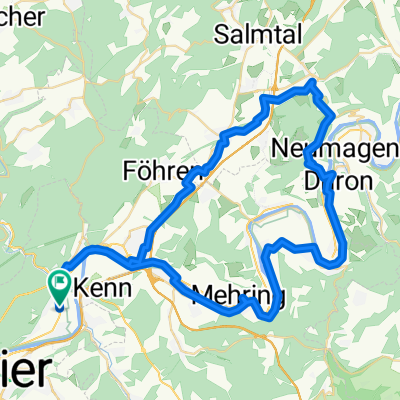
 Kenn - Grevenmacher
- Distance
- 65.2 km
- Ascent
- 138 m
- Descent
- 138 m
- Location
- Kenn, Rhineland-Palatinate, Germany
Open it in the app