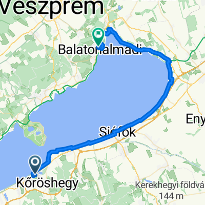
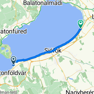
Ostbalaton
A cycling route starting in Balatonföldvár, Somogy County, Hungary.
Overview
About this route
Szantod - Zamadi - Siofok - Ostufer - Balatonalmadi - Balatonfüred - Tihany - Fähre - Szantod
- -:--
- Duration
- 80.2 km
- Distance
- 105 m
- Ascent
- 105 m
- Descent
- ---
- Avg. speed
- ---
- Max. altitude
Route quality
Waytypes & surfaces along the route
Waytypes
Quiet road
35.3 km
(44 %)
Cycleway
19.3 km
(24 %)
Surfaces
Paved
66.6 km
(83 %)
Asphalt
66.6 km
(83 %)
Undefined
13.6 km
(17 %)
Continue with Bikemap
Use, edit, or download this cycling route
You would like to ride Ostbalaton or customize it for your own trip? Here is what you can do with this Bikemap route:
Free features
- Save this route as favorite or in collections
- Copy & plan your own version of this route
- Split it into stages to create a multi-day tour
- Sync your route with Garmin or Wahoo
Premium features
Free trial for 3 days, or one-time payment. More about Bikemap Premium.
- Navigate this route on iOS & Android
- Export a GPX / KML file of this route
- Create your custom printout (try it for free)
- Download this route for offline navigation
Discover more Premium features.
Get Bikemap PremiumFrom our community
Other popular routes starting in Balatonföldvár
- Lengthy ride through Szántód
- Distance
- 199.7 km
- Ascent
- 190 m
- Descent
- 188 m
- Location
- Balatonföldvár, Somogy County, Hungary
- Széchenyi Imre utca - Somogyi Béla utca
- Distance
- 41.7 km
- Ascent
- 752 m
- Descent
- 754 m
- Location
- Balatonföldvár, Somogy County, Hungary
- Balatoni kör 2 nap
- Distance
- 82.6 km
- Ascent
- 163 m
- Descent
- 165 m
- Location
- Balatonföldvár, Somogy County, Hungary
- Kőrös hegyi tekergés 2.
- Distance
- 42 km
- Ascent
- 614 m
- Descent
- 616 m
- Location
- Balatonföldvár, Somogy County, Hungary
- Kőröshegyi tekergés
- Distance
- 37.2 km
- Ascent
- 540 m
- Descent
- 537 m
- Location
- Balatonföldvár, Somogy County, Hungary
- ZrĂnyi utca 8, SzántĂłd - ZrĂnyi utca 6, SzántĂłd
- Distance
- 65.8 km
- Ascent
- 503 m
- Descent
- 455 m
- Location
- Balatonföldvár, Somogy County, Hungary
- Balatoni kör 3 nap
- Distance
- 55.1 km
- Ascent
- 71 m
- Descent
- 64 m
- Location
- Balatonföldvár, Somogy County, Hungary
- OKKT 05
- Distance
- 886.4 km
- Ascent
- 4,432 m
- Descent
- 4,331 m
- Location
- Balatonföldvár, Somogy County, Hungary
Open it in the app