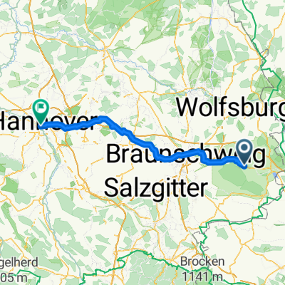
Königslutter am Elm - Hannover
- 98.3 km
- 247 m
- 336 m
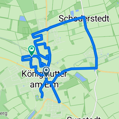
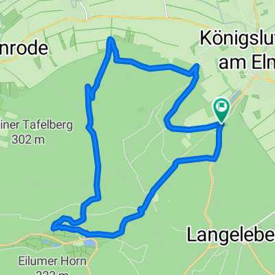
- Königslutter am Elm, Lower Saxony, Germany
A cycling route starting in Königslutter am Elm, Lower Saxony, Germany.
Overview
many small but steep climbs ... the last hill from Reitlingstal to the radio tower will hurt
created this 8 years ago
Route quality
Track
29.1 km
(69 %)
Path
5.9 km
(14 %)
Paved
8 km
(19 %)
Unpaved
31.2 km
(74 %)
Gravel
18.1 km
(43 %)
Unpaved (undefined)
7.2 km
(17 %)
Continue with Bikemap
You would like to ride Tim9 - Trocken or customize it for your own trip? Here is what you can do with this Bikemap route:
Free trial for 3 days, or one-time payment. More about Bikemap Premium.
Discover more Premium features.
Get Bikemap PremiumFrom our community
Open it in the app