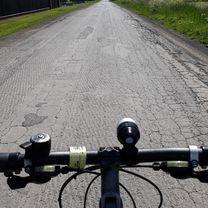
Kielce 2017 dzień 1
A cycling route starting in Radom, Masovian Voivodeship, Poland.
Overview
About this route
Radom (ul. Prażmowskiego-Czachowskiego-Żeromskiego-Lubelska-12) – Klwatka Królewska – Niemianowice – Gózd – Podzagajnik – Zwoleń (ul. Wiślana) – Mierzączka – Stefanów – Wysocin – Tymienica Nowa – Zajączków – Świesielice – Struga (79) – Gołębiów – Lipsko – Jadwinów – Śląsko – Daniszów – Walentynów – Maruszów – Kostusin – Czekarzewice – Tarłów – Wólka Tarłowska – Cegielnia – Mieczysławów – Łubowa – Lasocin – Linów (777) – Zawichost – Winiary – Winiarki – Słupcza – Dwikozy – Rzeczyca Mokra – Gierlachów – Mokoszyn – Sandomierz (77-723) – Tarnobrzeg (al. Niepodległości 2-871) – Tarnobrzeg (Vistula riverside)
- -:--
- Duration
- 156.4 km
- Distance
- 265 m
- Ascent
- 283 m
- Descent
- ---
- Avg. speed
- ---
- Max. altitude
Route quality
Waytypes & surfaces along the route
Waytypes
Road
32.8 km
(21 %)
Quiet road
32.8 km
(21 %)
Surfaces
Paved
106.4 km
(68 %)
Unpaved
3.1 km
(2 %)
Asphalt
104.8 km
(67 %)
Paved (undefined)
1.6 km
(1 %)
Continue with Bikemap
Use, edit, or download this cycling route
You would like to ride Kielce 2017 dzień 1 or customize it for your own trip? Here is what you can do with this Bikemap route:
Free features
- Save this route as favorite or in collections
- Copy & plan your own version of this route
- Split it into stages to create a multi-day tour
- Sync your route with Garmin or Wahoo
Premium features
Free trial for 3 days, or one-time payment. More about Bikemap Premium.
- Navigate this route on iOS & Android
- Export a GPX / KML file of this route
- Create your custom printout (try it for free)
- Download this route for offline navigation
Discover more Premium features.
Get Bikemap PremiumFrom our community
Other popular routes starting in Radom
 Królewskie Żródła
- Distance
- 76.6 km
- Ascent
- 156 m
- Descent
- 155 m
- Location
- Radom, Masovian Voivodeship, Poland
 Radom-Klwatka
- Distance
- 17.2 km
- Ascent
- 82 m
- Descent
- 82 m
- Location
- Radom, Masovian Voivodeship, Poland
 Do Ilzy
- Distance
- 81.4 km
- Ascent
- 0 m
- Descent
- 0 m
- Location
- Radom, Masovian Voivodeship, Poland
 ... setka na północ i 3xOlszowa
- Distance
- 107.6 km
- Ascent
- 196 m
- Descent
- 196 m
- Location
- Radom, Masovian Voivodeship, Poland
 Radom - Grzybowa Góra z małym okładem
- Distance
- 152.8 km
- Ascent
- 422 m
- Descent
- 421 m
- Location
- Radom, Masovian Voivodeship, Poland
 Radom 50km
- Distance
- 50.3 km
- Ascent
- 276 m
- Descent
- 276 m
- Location
- Radom, Masovian Voivodeship, Poland
 leśna trasa
- Distance
- 61.2 km
- Ascent
- 157 m
- Descent
- 154 m
- Location
- Radom, Masovian Voivodeship, Poland
 Radom - Ciepielów(Stary Kawęczyn) i z powrotem
- Distance
- 100.4 km
- Ascent
- 137 m
- Descent
- 140 m
- Location
- Radom, Masovian Voivodeship, Poland
Open it in the app


