

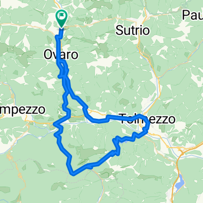
Com_88km_2200m_V
A cycling route starting in Comeglians, Friuli Venezia Giulia, Italy.
Overview
About this route
- -:--
- Duration
- 87.8 km
- Distance
- 1,943 m
- Ascent
- 1,942 m
- Descent
- ---
- Avg. speed
- ---
- Max. altitude
Route quality
Waytypes & surfaces along the route
Waytypes
Road
51.8 km
(59 %)
Quiet road
3.5 km
(4 %)
Undefined
32.5 km
(37 %)
Surfaces
Paved
36 km
(41 %)
Asphalt
36 km
(41 %)
Undefined
51.8 km
(59 %)
Continue with Bikemap
Use, edit, or download this cycling route
You would like to ride Com_88km_2200m_V or customize it for your own trip? Here is what you can do with this Bikemap route:
Free features
- Save this route as favorite or in collections
- Copy & plan your own version of this route
- Split it into stages to create a multi-day tour
- Sync your route with Garmin or Wahoo
Premium features
Free trial for 3 days, or one-time payment. More about Bikemap Premium.
- Navigate this route on iOS & Android
- Export a GPX / KML file of this route
- Create your custom printout (try it for free)
- Download this route for offline navigation
Discover more Premium features.
Get Bikemap PremiumFrom our community
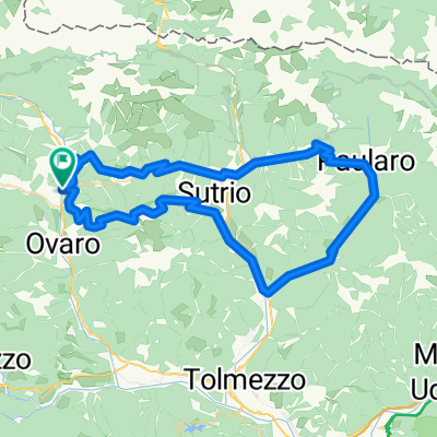
Other popular routes starting in Comeglians
 2025 zoncolan C 2. Tag
- Distance
- 77.6 km
- Ascent
- 3,823 m
- Descent
- 3,823 m
- Location
- Comeglians, Friuli Venezia Giulia, Italy
 Visit Giro - etapa 15, 20. maj 2018
- Distance
- 111.2 km
- Ascent
- 2,604 m
- Descent
- 2,604 m
- Location
- Comeglians, Friuli Venezia Giulia, Italy
 Com_88km_2200m_V
- Distance
- 87.8 km
- Ascent
- 1,943 m
- Descent
- 1,942 m
- Location
- Comeglians, Friuli Venezia Giulia, Italy
 Monte Zoncolan (Italy)
- Distance
- 40.8 km
- Ascent
- 1,636 m
- Descent
- 1,638 m
- Location
- Comeglians, Friuli Venezia Giulia, Italy
 2025 Friaul Tag3
- Distance
- 76.9 km
- Ascent
- 2,553 m
- Descent
- 2,553 m
- Location
- Comeglians, Friuli Venezia Giulia, Italy
 Comeglians - Zoncolan 84,5 km
- Distance
- 84.7 km
- Ascent
- 3,413 m
- Descent
- 2,248 m
- Location
- Comeglians, Friuli Venezia Giulia, Italy
 2025 zoncolan C 2. Tag
- Distance
- 75.1 km
- Ascent
- 3,711 m
- Descent
- 3,711 m
- Location
- Comeglians, Friuli Venezia Giulia, Italy
 Dolomite East - West (Bolzano)
- Distance
- 218.7 km
- Ascent
- 4,786 m
- Descent
- 5,045 m
- Location
- Comeglians, Friuli Venezia Giulia, Italy
Open it in the app