

Eggolsheim-Feuerstein, Fränkische Schweiz
A cycling route starting in Eggolsheim, Bavaria, Germany.
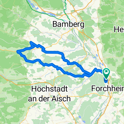
Overview
About this route
Geteerter Radweg von Eggolsheim bis Weigelshofen. Ab Weigelshofen bis Drosendorf Landstrasse ohne Radweg, und ab Drosendorf recht steil bergauf auf die Lange Meile. Dort ebene, unbefestigte Waldwege bis Flughafen Feuerstein, und ab da bergab bis nach Kauernhofen. Schöne Aussicht über Regnitztal und Weibala auf der anderen Seite. Landstrasse zurück nach Eggolsheim
- -:--
- Duration
- 17.7 km
- Distance
- 335 m
- Ascent
- 223 m
- Descent
- ---
- Avg. speed
- 526 m
- Max. altitude
Route quality
Waytypes & surfaces along the route
Waytypes
Track
8.2 km
(46 %)
Road
3.7 km
(21 %)
Surfaces
Paved
7.3 km
(42 %)
Unpaved
7.2 km
(41 %)
Asphalt
7.3 km
(42 %)
Gravel
3.5 km
(20 %)
Route highlights
Points of interest along the route
Point of interest after 3.8 km
Point of interest after 3.9 km
Continue with Bikemap
Use, edit, or download this cycling route
You would like to ride Eggolsheim-Feuerstein, Fränkische Schweiz or customize it for your own trip? Here is what you can do with this Bikemap route:
Free features
- Save this route as favorite or in collections
- Copy & plan your own version of this route
- Sync your route with Garmin or Wahoo
Premium features
Free trial for 3 days, or one-time payment. More about Bikemap Premium.
- Navigate this route on iOS & Android
- Export a GPX / KML file of this route
- Create your custom printout (try it for free)
- Download this route for offline navigation
Discover more Premium features.
Get Bikemap PremiumFrom our community
Other popular routes starting in Eggolsheim
 Herrenausflug zur Bärenschlucht
- Distance
- 37.8 km
- Ascent
- 359 m
- Descent
- 254 m
- Location
- Eggolsheim, Bavaria, Germany
 2014 Forchheim-Reiche Ebrach Tal
- Distance
- 53.7 km
- Ascent
- 216 m
- Descent
- 128 m
- Location
- Eggolsheim, Bavaria, Germany
 Mai-Tour Franken-Pedalos
- Distance
- 16 km
- Ascent
- 171 m
- Descent
- 171 m
- Location
- Eggolsheim, Bavaria, Germany
 Forchheim_Ampfersbach_Moenchsambach
- Distance
- 77.1 km
- Ascent
- 386 m
- Descent
- 387 m
- Location
- Eggolsheim, Bavaria, Germany
 Herrenausflug zur Bärenschlucht
- Distance
- 37.8 km
- Ascent
- 324 m
- Descent
- 219 m
- Location
- Eggolsheim, Bavaria, Germany
 Sprint Bei Gegenwind
- Distance
- 42.6 km
- Ascent
- 839 m
- Descent
- 840 m
- Location
- Eggolsheim, Bavaria, Germany
 Forchheim_Huppendorf_Steinfeld
- Distance
- 87.7 km
- Ascent
- 635 m
- Descent
- 636 m
- Location
- Eggolsheim, Bavaria, Germany
 Eggolsheim-Feuerstein, Fränkische Schweiz
- Distance
- 17.7 km
- Ascent
- 335 m
- Descent
- 223 m
- Location
- Eggolsheim, Bavaria, Germany
Open it in the app