

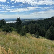
Vicki & RJ's Big Bike Ride
A cycling route starting in Laporte, Colorado, United States of America.
Overview
About this route
- -:--
- Duration
- 18.5 km
- Distance
- 44 m
- Ascent
- 60 m
- Descent
- ---
- Avg. speed
- ---
- Max. altitude

Route quality
Waytypes & surfaces along the route
Waytypes
Cycleway
6.4 km
(35 %)
Pedestrian area
4.6 km
(25 %)
Surfaces
Paved
15.3 km
(83 %)
Concrete
6.4 km
(35 %)
Asphalt
4.6 km
(25 %)
Continue with Bikemap
Use, edit, or download this cycling route
You would like to ride Vicki & RJ's Big Bike Ride or customize it for your own trip? Here is what you can do with this Bikemap route:
Free features
- Save this route as favorite or in collections
- Copy & plan your own version of this route
- Sync your route with Garmin or Wahoo
Premium features
Free trial for 3 days, or one-time payment. More about Bikemap Premium.
- Navigate this route on iOS & Android
- Export a GPX / KML file of this route
- Create your custom printout (try it for free)
- Download this route for offline navigation
Discover more Premium features.
Get Bikemap PremiumFrom our community
Other popular routes starting in Laporte
 maxwell
- Distance
- 36.8 km
- Ascent
- 367 m
- Descent
- 366 m
- Location
- Laporte, Colorado, United States of America
 Arthur's Rock Trail, Loveland to Arthur's Rock Trail, Loveland
- Distance
- 6 km
- Ascent
- 369 m
- Descent
- 367 m
- Location
- Laporte, Colorado, United States of America
 Vicki & RJ's Big Bike Ride
- Distance
- 18.5 km
- Ascent
- 44 m
- Descent
- 60 m
- Location
- Laporte, Colorado, United States of America
 2739 Headwater Dr, Fort Collins to 2739 Headwater Dr, Fort Collins
- Distance
- 31.4 km
- Ascent
- 131 m
- Descent
- 131 m
- Location
- Laporte, Colorado, United States of America
 1300–1386 N Overland Trail, Fort Collins to 538 S Taft Hill Rd, Fort Collins
- Distance
- 25.9 km
- Ascent
- 313 m
- Descent
- 320 m
- Location
- Laporte, Colorado, United States of America
 Big Loop Arthur
- Distance
- 10 km
- Ascent
- 436 m
- Descent
- 434 m
- Location
- Laporte, Colorado, United States of America
 Route to 423 Franklin St, Fort Collins
- Distance
- 10.7 km
- Ascent
- 77 m
- Descent
- 109 m
- Location
- Laporte, Colorado, United States of America
 Route to 1425 N Overland Trail, Fort Collins
- Distance
- 5.6 km
- Ascent
- 75 m
- Descent
- 87 m
- Location
- Laporte, Colorado, United States of America
Open it in the app