

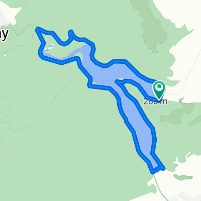
Uppony-Szentlélek-Bánkút-Szilvás-Sáta-Uppony
A cycling route starting in Putnok, Borsod-Abauj Zemplen county, Hungary.
Overview
About this route
- -:--
- Duration
- 75.1 km
- Distance
- 975 m
- Ascent
- 978 m
- Descent
- ---
- Avg. speed
- ---
- Max. altitude

Route quality
Waytypes & surfaces along the route
Waytypes
Quiet road
21 km
(28 %)
Track
9 km
(12 %)
Surfaces
Paved
39.1 km
(52 %)
Unpaved
4.5 km
(6 %)
Asphalt
38.3 km
(51 %)
Gravel
3 km
(4 %)
Continue with Bikemap
Use, edit, or download this cycling route
You would like to ride Uppony-Szentlélek-Bánkút-Szilvás-Sáta-Uppony or customize it for your own trip? Here is what you can do with this Bikemap route:
Free features
- Save this route as favorite or in collections
- Copy & plan your own version of this route
- Sync your route with Garmin or Wahoo
Premium features
Free trial for 3 days, or one-time payment. More about Bikemap Premium.
- Navigate this route on iOS & Android
- Export a GPX / KML file of this route
- Create your custom printout (try it for free)
- Download this route for offline navigation
Discover more Premium features.
Get Bikemap PremiumFrom our community
Other popular routes starting in Putnok
 Lázbérci-víztározó körtúra
- Distance
- 9.4 km
- Ascent
- 210 m
- Descent
- 212 m
- Location
- Putnok, Borsod-Abauj Zemplen county, Hungary
 Putnok-Alsótelekes-Edelény
- Distance
- 57 km
- Ascent
- 674 m
- Descent
- 701 m
- Location
- Putnok, Borsod-Abauj Zemplen county, Hungary
 LG_KT2023_2nap
- Distance
- 46.1 km
- Ascent
- 604 m
- Descent
- 601 m
- Location
- Putnok, Borsod-Abauj Zemplen county, Hungary
 Aggtelek 4.
- Distance
- 22.3 km
- Ascent
- 330 m
- Descent
- 225 m
- Location
- Putnok, Borsod-Abauj Zemplen county, Hungary
 LG_KT2023_3nap
- Distance
- 52.6 km
- Ascent
- 421 m
- Descent
- 451 m
- Location
- Putnok, Borsod-Abauj Zemplen county, Hungary
 OKT Gömöri Kék 1
- Distance
- 18.2 km
- Ascent
- 303 m
- Descent
- 233 m
- Location
- Putnok, Borsod-Abauj Zemplen county, Hungary
 Kalica tető
- Distance
- 15 km
- Ascent
- 375 m
- Descent
- 370 m
- Location
- Putnok, Borsod-Abauj Zemplen county, Hungary
 Upponyi szoros - Damasa szakadék
- Distance
- 6.9 km
- Ascent
- 276 m
- Descent
- 115 m
- Location
- Putnok, Borsod-Abauj Zemplen county, Hungary
Open it in the app