

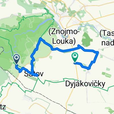
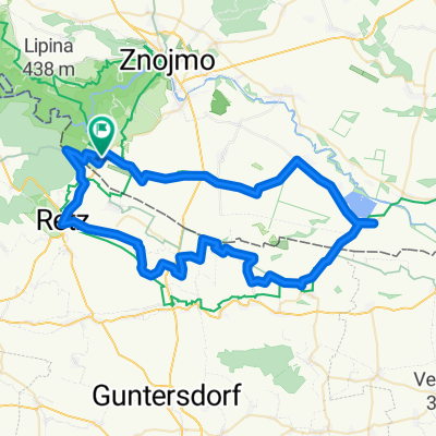
Hotel Happy Star - Znojmo --HHS okruh
A cycling route starting in Šatov, South Moravian, Czechia.
Overview
About this route
- -:--
- Duration
- 38.7 km
- Distance
- 445 m
- Ascent
- 444 m
- Descent
- ---
- Avg. speed
- ---
- Max. altitude
Route quality
Waytypes & surfaces along the route
Waytypes
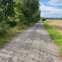
Track
25.2 km
(65 %)
Path
4.6 km
(12 %)
Surfaces
Paved
10.1 km
(26 %)
Unpaved
17.8 km
(46 %)
Unpaved (undefined)
9.3 km
(24 %)
Asphalt
7.7 km
(20 %)
Route highlights
Points of interest along the route
Point of interest after 5.9 km
Sealsfield
Point of interest after 11.7 km
Znojemská rotunda
Point of interest after 13.8 km
Chrám sv. Mikuláše
Point of interest after 18.6 km
Paduánská kaple - vyhlídka
Point of interest after 23 km
Králův stolec
Point of interest after 34.6 km
Šobes
Point of interest after 36.3 km
Mlýn papírna
Continue with Bikemap
Use, edit, or download this cycling route
You would like to ride Hotel Happy Star - Znojmo --HHS okruh or customize it for your own trip? Here is what you can do with this Bikemap route:
Free features
- Save this route as favorite or in collections
- Copy & plan your own version of this route
- Sync your route with Garmin or Wahoo
Premium features
Free trial for 3 days, or one-time payment. More about Bikemap Premium.
- Navigate this route on iOS & Android
- Export a GPX / KML file of this route
- Create your custom printout (try it for free)
- Download this route for offline navigation
Discover more Premium features.
Get Bikemap PremiumFrom our community
Other popular routes starting in Šatov
 Znojmo Wine
- Distance
- 22.3 km
- Ascent
- 165 m
- Descent
- 246 m
- Location
- Šatov, South Moravian, Czechia
 MORAVA-9.den-23.7.13
- Distance
- 29.4 km
- Ascent
- 545 m
- Descent
- 372 m
- Location
- Šatov, South Moravian, Czechia
 Hnanice - Retz - Jaroslavice -Hnanice - 68km
- Distance
- 68.8 km
- Ascent
- 478 m
- Descent
- 480 m
- Location
- Šatov, South Moravian, Czechia
 KUKA TOUR 2014 - 1. etapa
- Distance
- 77.9 km
- Ascent
- 758 m
- Descent
- 753 m
- Location
- Šatov, South Moravian, Czechia
 ZWISCHEN HARDEGG UND ZNAIM
- Distance
- 63.8 km
- Ascent
- 891 m
- Descent
- 890 m
- Location
- Šatov, South Moravian, Czechia
 1397/36
- Distance
- 44.5 km
- Ascent
- 458 m
- Descent
- 458 m
- Location
- Šatov, South Moravian, Czechia
 Hardegg - Falkenstein (Kamp-Thaya-March 3)
- Distance
- 76.6 km
- Ascent
- 465 m
- Descent
- 469 m
- Location
- Šatov, South Moravian, Czechia
 Hnanice - Cižov
- Distance
- 14.6 km
- Ascent
- 780 m
- Descent
- 638 m
- Location
- Šatov, South Moravian, Czechia
Open it in the app