

Einmal um das Weinsberger Tal
A cycling route starting in Eberstadt, Baden-Wurttemberg, Germany.
Overview
About this route
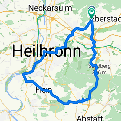
Starting in Eberstadt, it goes up and down continuously. There are steeper climbs, such as from Lehrensteinsfeld towards Waldheide. But there are also fast descents, for instance in Weinsberg on Kirschenallee. This tour is modeled after the official WT3.
- -:--
- Duration
- 64.3 km
- Distance
- 815 m
- Ascent
- 816 m
- Descent
- ---
- Avg. speed
- ---
- Max. altitude

Route quality
Waytypes & surfaces along the route
Waytypes
Track
39.2 km
(61 %)
Road
10.9 km
(17 %)
Surfaces
Paved
51.5 km
(80 %)
Unpaved
7.1 km
(11 %)
Asphalt
44.4 km
(69 %)
Paved (undefined)
6.4 km
(10 %)
Continue with Bikemap
Use, edit, or download this cycling route
You would like to ride Einmal um das Weinsberger Tal or customize it for your own trip? Here is what you can do with this Bikemap route:
Free features
- Save this route as favorite or in collections
- Copy & plan your own version of this route
- Sync your route with Garmin or Wahoo
Premium features
Free trial for 3 days, or one-time payment. More about Bikemap Premium.
- Navigate this route on iOS & Android
- Export a GPX / KML file of this route
- Create your custom printout (try it for free)
- Download this route for offline navigation
Discover more Premium features.
Get Bikemap PremiumFrom our community
Other popular routes starting in Eberstadt
 06.01.2020
- Distance
- 20.2 km
- Ascent
- 307 m
- Descent
- 307 m
- Location
- Eberstadt, Baden-Wurttemberg, Germany
 Eberstadt - Jagst
- Distance
- 52.9 km
- Ascent
- 340 m
- Descent
- 339 m
- Location
- Eberstadt, Baden-Wurttemberg, Germany
 Gellmersbach-Ilsfeld-Schozach-HN-Erlenbach-Gellmersbach
- Distance
- 42 km
- Ascent
- 504 m
- Descent
- 502 m
- Location
- Eberstadt, Baden-Wurttemberg, Germany
 Einmal um das Weinsberger Tal
- Distance
- 64.3 km
- Ascent
- 815 m
- Descent
- 816 m
- Location
- Eberstadt, Baden-Wurttemberg, Germany
 Ensommertraining 21-09-2010
- Distance
- 46.8 km
- Ascent
- 407 m
- Descent
- 406 m
- Location
- Eberstadt, Baden-Wurttemberg, Germany
 Waldenburg-Dahenfeld
- Distance
- 88.1 km
- Ascent
- 1,120 m
- Descent
- 1,167 m
- Location
- Eberstadt, Baden-Wurttemberg, Germany
 RC-Pfeil-Marathon 2007 (ungefährer Verlauf)
- Distance
- 28.4 km
- Ascent
- 537 m
- Descent
- 537 m
- Location
- Eberstadt, Baden-Wurttemberg, Germany
 Sonntagstour 08.03.2020
- Distance
- 38 km
- Ascent
- 449 m
- Descent
- 446 m
- Location
- Eberstadt, Baden-Wurttemberg, Germany
Open it in the app