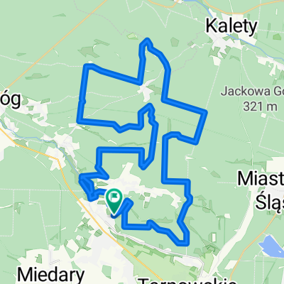
Świerklaniec - Ossy
- 27.8 km
- 123 m
- 127 m
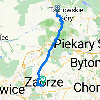
- Tarnowskie Góry, Silesian Voivodeship, Poland
A cycling route starting in Tarnowskie Góry, Silesian Voivodeship, Poland.
Overview
created this 8 years ago
Route quality
Road
47.2 km
(57 %)
Quiet road
14.1 km
(17 %)
Paved
69.6 km
(84 %)
Unpaved
0.8 km
(1 %)
Asphalt
67.1 km
(81 %)
Paved (undefined)
2.5 km
(3 %)
Continue with Bikemap
You would like to ride Long ride through Tarnowskie Góry or customize it for your own trip? Here is what you can do with this Bikemap route:
Free trial for 3 days, or one-time payment. More about Bikemap Premium.
Discover more Premium features.
Get Bikemap PremiumFrom our community
Open it in the app