

Hilter-Feldmarksee-Hilter
A cycling route starting in Hilter, Lower Saxony, Germany.
Overview
About this route
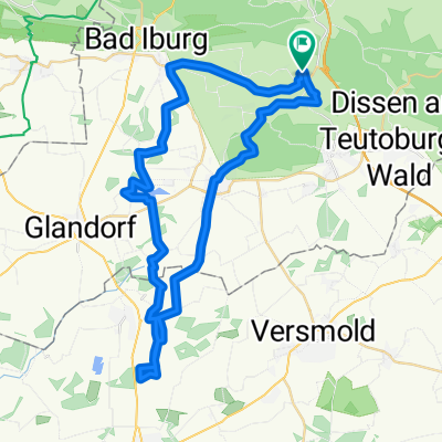
Tour über verkehrsarme Wirtschaftsweg ohne Steigungen. Die Tour wurde am 11.9.2017 geradelt.
Einkehrmöglichkeit ist das Park-Cafe in Bad Laer.
- -:--
- Duration
- 49.6 km
- Distance
- 138 m
- Ascent
- 145 m
- Descent
- ---
- Avg. speed
- ---
- Max. altitude

Route quality
Waytypes & surfaces along the route
Waytypes
Quiet road
34.6 km
(70 %)
Path
5.4 km
(11 %)
Surfaces
Paved
29.7 km
(60 %)
Unpaved
1.6 km
(3 %)
Asphalt
26.4 km
(53 %)
Paving stones
2.3 km
(5 %)
Continue with Bikemap
Use, edit, or download this cycling route
You would like to ride Hilter-Feldmarksee-Hilter or customize it for your own trip? Here is what you can do with this Bikemap route:
Free features
- Save this route as favorite or in collections
- Copy & plan your own version of this route
- Sync your route with Garmin or Wahoo
Premium features
Free trial for 3 days, or one-time payment. More about Bikemap Premium.
- Navigate this route on iOS & Android
- Export a GPX / KML file of this route
- Create your custom printout (try it for free)
- Download this route for offline navigation
Discover more Premium features.
Get Bikemap PremiumFrom our community
Other popular routes starting in Hilter
 Dissener Aussichtsturm & Luisenturm
- Distance
- 28.5 km
- Ascent
- 408 m
- Descent
- 410 m
- Location
- Hilter, Lower Saxony, Germany
 Dreckige Fun Tour
- Distance
- 19.7 km
- Ascent
- 292 m
- Descent
- 292 m
- Location
- Hilter, Lower Saxony, Germany
 2. Strecke am 26.02.2010 von Sabse und Achilles
- Distance
- 11.3 km
- Ascent
- 63 m
- Descent
- 55 m
- Location
- Hilter, Lower Saxony, Germany
 emsländerroute
- Distance
- 15.4 km
- Ascent
- 393 m
- Descent
- 393 m
- Location
- Hilter, Lower Saxony, Germany
 Die Olaf Tour
- Distance
- 25.5 km
- Ascent
- 178 m
- Descent
- 178 m
- Location
- Hilter, Lower Saxony, Germany
 Lange Radrunde durch Hilter am Teutoburger Wald
- Distance
- 79.3 km
- Ascent
- 514 m
- Descent
- 516 m
- Location
- Hilter, Lower Saxony, Germany
 Einfach nur fahren.gpx
- Distance
- 46.1 km
- Ascent
- 163 m
- Descent
- 163 m
- Location
- Hilter, Lower Saxony, Germany
 Aussichtsturm Fun
- Distance
- 34.8 km
- Ascent
- 609 m
- Descent
- 609 m
- Location
- Hilter, Lower Saxony, Germany
Open it in the app