

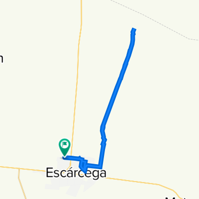
2010-03-20 Escarcega to Campeche
A cycling route starting in Escárcega, Campeche, Mexico.
Overview
About this route
Route from GPS track. <br /><br />Höhenmeter nach barometrischem Höhenmesser / Vertical climb according to barometric altimeter: 716 m
- -:--
- Duration
- 153.8 km
- Distance
- 319 m
- Ascent
- 398 m
- Descent
- ---
- Avg. speed
- ---
- Max. altitude
Continue with Bikemap
Use, edit, or download this cycling route
You would like to ride 2010-03-20 Escarcega to Campeche or customize it for your own trip? Here is what you can do with this Bikemap route:
Free features
- Save this route as favorite or in collections
- Copy & plan your own version of this route
- Split it into stages to create a multi-day tour
- Sync your route with Garmin or Wahoo
Premium features
Free trial for 3 days, or one-time payment. More about Bikemap Premium.
- Navigate this route on iOS & Android
- Export a GPX / KML file of this route
- Create your custom printout (try it for free)
- Download this route for offline navigation
Discover more Premium features.
Get Bikemap PremiumFrom our community
Other popular routes starting in Escárcega
 De Escárcega a Escárcega
- Distance
- 33.1 km
- Ascent
- 316 m
- Descent
- 312 m
- Location
- Escárcega, Campeche, Mexico
 De Calle 28 30, Escárcega a Calle 28 s/n, Escárcega
- Distance
- 1.3 km
- Ascent
- 2 m
- Descent
- 3 m
- Location
- Escárcega, Campeche, Mexico
 2010-03-20 Escarcega to Campeche
- Distance
- 153.8 km
- Ascent
- 319 m
- Descent
- 398 m
- Location
- Escárcega, Campeche, Mexico
 De Calle 63-a 63b, Escárcega a Calle 48-A 8, Escárcega
- Distance
- 23.5 km
- Ascent
- 102 m
- Descent
- 102 m
- Location
- Escárcega, Campeche, Mexico
 De Concordia 14, Escárcega a Concordia 14, Escárcega
- Distance
- 13.2 km
- Ascent
- 105 m
- Descent
- 101 m
- Location
- Escárcega, Campeche, Mexico
 basurero
- Distance
- 18.4 km
- Ascent
- 139 m
- Descent
- 153 m
- Location
- Escárcega, Campeche, Mexico
 La Chiquita, La Chiquita a La Chiquita, La Chiquita
- Distance
- 7.9 km
- Ascent
- 88 m
- Descent
- 93 m
- Location
- Escárcega, Campeche, Mexico
 La Chiquita, La Chiquita a 31, Escárcega
- Distance
- 19.5 km
- Ascent
- 271 m
- Descent
- 292 m
- Location
- Escárcega, Campeche, Mexico
Open it in the app