

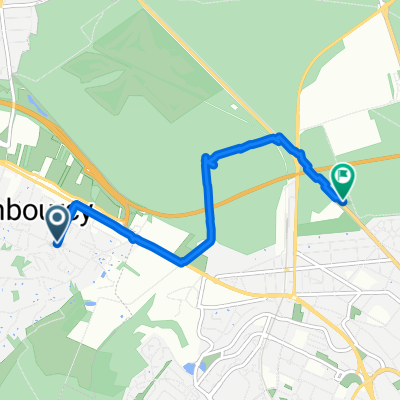
Chambourcy - Buc 1
A cycling route starting in Chambourcy, Île-de-France Region, France.
Overview
About this route
- -:--
- Duration
- 24.5 km
- Distance
- 299 m
- Ascent
- 247 m
- Descent
- ---
- Avg. speed
- ---
- Max. altitude

Route quality
Waytypes & surfaces along the route
Waytypes
Cycleway
5.9 km
(24 %)
Quiet road
5.6 km
(23 %)
Surfaces
Paved
17.3 km
(71 %)
Unpaved
1.1 km
(5 %)
Asphalt
17 km
(69 %)
Ground
1.1 km
(4 %)
Continue with Bikemap
Use, edit, or download this cycling route
You would like to ride Chambourcy - Buc 1 or customize it for your own trip? Here is what you can do with this Bikemap route:
Free features
- Save this route as favorite or in collections
- Copy & plan your own version of this route
- Sync your route with Garmin or Wahoo
Premium features
Free trial for 3 days, or one-time payment. More about Bikemap Premium.
- Navigate this route on iOS & Android
- Export a GPX / KML file of this route
- Create your custom printout (try it for free)
- Download this route for offline navigation
Discover more Premium features.
Get Bikemap PremiumFrom our community
Other popular routes starting in Chambourcy
 58Km tour
- Distance
- 58 km
- Ascent
- 459 m
- Descent
- 466 m
- Location
- Chambourcy, Île-de-France Region, France
 Chambourcy - Buc 1
- Distance
- 24.5 km
- Ascent
- 299 m
- Descent
- 247 m
- Location
- Chambourcy, Île-de-France Region, France
 Rue de Gramont, Chambourcy à Route de la Mare d'Ayen, Saint-Germain-en-Laye
- Distance
- 4.8 km
- Ascent
- 23 m
- Descent
- 54 m
- Location
- Chambourcy, Île-de-France Region, France
 80kM Thoiry reverse
- Distance
- 80.6 km
- Ascent
- 625 m
- Descent
- 641 m
- Location
- Chambourcy, Île-de-France Region, France
 56KM Chapet_Plaisir
- Distance
- 56.2 km
- Ascent
- 447 m
- Descent
- 446 m
- Location
- Chambourcy, Île-de-France Region, France
 53 KM Chapet_Plaisir
- Distance
- 53.3 km
- Ascent
- 423 m
- Descent
- 420 m
- Location
- Chambourcy, Île-de-France Region, France
 92Km Autour de poissy
- Distance
- 93.1 km
- Ascent
- 374 m
- Descent
- 422 m
- Location
- Chambourcy, Île-de-France Region, France
 80 D113, Chambourcy to 3–10 Impasse du Val, Fourqueux
- Distance
- 4.8 km
- Ascent
- 3 m
- Descent
- 3 m
- Location
- Chambourcy, Île-de-France Region, France
Open it in the app