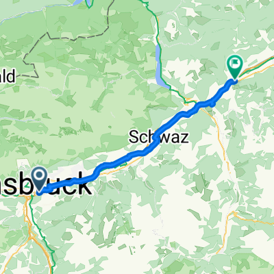
Innsbruck / Zirl / Magdeburger Hüttn / Kranebitten
A cycling route starting in Innsbruck, Tyrol, Austria.
Overview
About this route
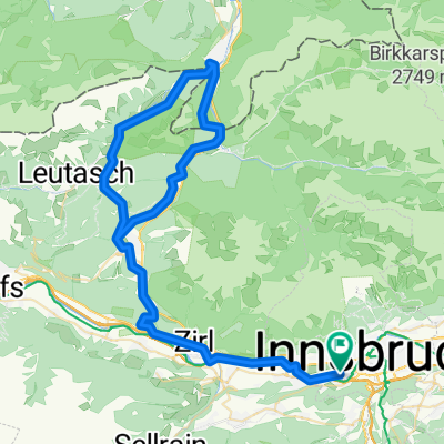
Herrlicher Schotterweg über Hochzirl zur Magdeburger Hütte
- 4 h 58 min
- Duration
- 52.2 km
- Distance
- 1,200 m
- Ascent
- 1,199 m
- Descent
- 10.5 km/h
- Avg. speed
- ---
- Avg. speed
Route photos
Route highlights
Points of interest along the route
Point of interest after 18.7 km
Bild
Point of interest after 21.8 km
Bild
Point of interest after 34.5 km
Kapelle
Continue with Bikemap
Use, edit, or download this cycling route
You would like to ride Innsbruck / Zirl / Magdeburger Hüttn / Kranebitten or customize it for your own trip? Here is what you can do with this Bikemap route:
Free features
- Save this route as favorite or in collections
- Copy & plan your own version of this route
- Sync your route with Garmin or Wahoo
Premium features
Free trial for 3 days, or one-time payment. More about Bikemap Premium.
- Navigate this route on iOS & Android
- Export a GPX / KML file of this route
- Create your custom printout (try it for free)
- Download this route for offline navigation
Discover more Premium features.
Get Bikemap PremiumFrom our community
Other popular routes starting in Innsbruck
- Innsbruck II
- Distance
- 15.7 km
- Ascent
- 1,386 m
- Descent
- 0 m
- Location
- Innsbruck, Tyrol, Austria
- Am Roßsprung 1, Innsbruck nach Am Roßsprung 1, Innsbruck
- Distance
- 40 km
- Ascent
- 622 m
- Descent
- 674 m
- Location
- Innsbruck, Tyrol, Austria
- IBK - Maria Waldrast - IBK
- Distance
- 62.1 km
- Ascent
- 1,628 m
- Descent
- 1,626 m
- Location
- Innsbruck, Tyrol, Austria
- IBK-Axamer Lizum-IBK
- Distance
- 46.6 km
- Ascent
- 1,175 m
- Descent
- 1,178 m
- Location
- Innsbruck, Tyrol, Austria
- Innsbruck - Imst_original 001
- Distance
- 62.1 km
- Ascent
- 588 m
- Descent
- 448 m
- Location
- Innsbruck, Tyrol, Austria
- Innsbruck-Innsbruck
- Distance
- 387.2 km
- Ascent
- 7,188 m
- Descent
- 7,210 m
- Location
- Innsbruck, Tyrol, Austria
- 007
- Distance
- 87.9 km
- Ascent
- 2,182 m
- Descent
- 2,100 m
- Location
- Innsbruck, Tyrol, Austria
- Nockspitz-Überschreitung
- Distance
- 54 km
- Ascent
- 2,398 m
- Descent
- 2,385 m
- Location
- Innsbruck, Tyrol, Austria
Open it in the app