

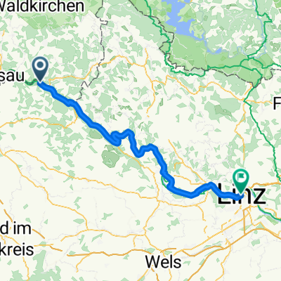
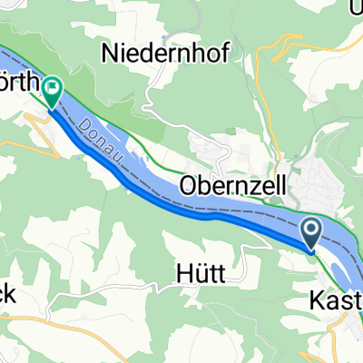
Engelhartszell - Wilhering 1
A cycling route starting in Pfarrkirchen im Mühlkreis, Upper Austria, Austria.
Overview
About this route
Engelhartszell, Wilhering am rechten Donauufer
- -:--
- Duration
- 60.1 km
- Distance
- 337 m
- Ascent
- 349 m
- Descent
- ---
- Avg. speed
- ---
- Max. altitude

Route quality
Waytypes & surfaces along the route
Waytypes
Quiet road
27 km
(45 %)
Track
18 km
(30 %)
Surfaces
Paved
54.1 km
(90 %)
Unpaved
2.4 km
(4 %)
Asphalt
54.1 km
(90 %)
Ground
1.8 km
(3 %)
Continue with Bikemap
Use, edit, or download this cycling route
You would like to ride Engelhartszell - Wilhering 1 or customize it for your own trip? Here is what you can do with this Bikemap route:
Free features
- Save this route as favorite or in collections
- Copy & plan your own version of this route
- Sync your route with Garmin or Wahoo
Premium features
Free trial for 3 days, or one-time payment. More about Bikemap Premium.
- Navigate this route on iOS & Android
- Export a GPX / KML file of this route
- Create your custom printout (try it for free)
- Download this route for offline navigation
Discover more Premium features.
Get Bikemap PremiumFrom our community
Other popular routes starting in Pfarrkirchen im Mühlkreis
 Pfarrkirchen im Mühlkreis - Linz
- Distance
- 79.3 km
- Ascent
- 27 m
- Descent
- 86 m
- Location
- Pfarrkirchen im Mühlkreis, Upper Austria, Austria
 2.28 Pension Feiken - Enns Goldenen Schiff
- Distance
- 87.2 km
- Ascent
- 926 m
- Descent
- 977 m
- Location
- Pfarrkirchen im Mühlkreis, Upper Austria, Austria
 12.Engelhartszell-Hofkirchen
- Distance
- 60.6 km
- Ascent
- 586 m
- Descent
- 574 m
- Location
- Pfarrkirchen im Mühlkreis, Upper Austria, Austria
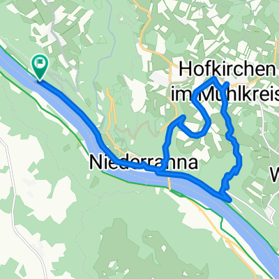
 Donaurunde Obernzell - Niederranna und zurück
- Distance
- 36.8 km
- Ascent
- 286 m
- Descent
- 413 m
- Location
- Pfarrkirchen im Mühlkreis, Upper Austria, Austria
 E10.2. 16.7.25 Passau nach Au
- Distance
- 16.2 km
- Ascent
- 87 m
- Descent
- 149 m
- Location
- Pfarrkirchen im Mühlkreis, Upper Austria, Austria
 Deggendorf - Pfarrkirchen im Mühlkreis
- Distance
- 3.5 km
- Ascent
- 39 m
- Descent
- 68 m
- Location
- Pfarrkirchen im Mühlkreis, Upper Austria, Austria
 Route zu Gasthof Luger
- Distance
- 15.2 km
- Ascent
- 413 m
- Descent
- 416 m
- Location
- Pfarrkirchen im Mühlkreis, Upper Austria, Austria
 Teil 7: Von Engelhartszell bis Gallneukirchen
- Distance
- 82.4 km
- Ascent
- 1,349 m
- Descent
- 1,314 m
- Location
- Pfarrkirchen im Mühlkreis, Upper Austria, Austria
Open it in the app