
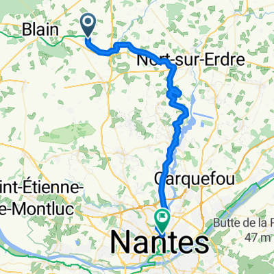
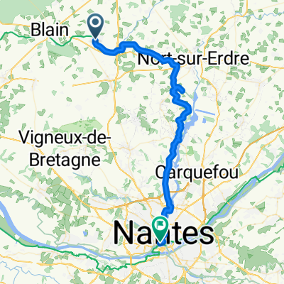
2 Heric to La Limouziniere
A cycling route starting in Héric, Pays de la Loire Region, France.
Overview
About this route
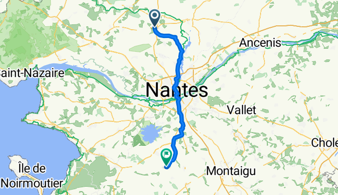
From Heric, D237 then L on D37 (under E03) through Casson then R at Suce-sur-Erdre on D69 towards Nantes via La Chapelle-sur-Erdre and D39. Over E60 then L at 3rd rdbt (over E62), along Blvds Martin Luther King then Guy Mollet. Follow 1WS R along Blvd Gabriel Lauriol, R at rdbt on to Blvd Freres de Goncourt then L at next rdbt on to Rues Paul Bellamy then de Strasbourg. At end turn R, past University Hospital then L at rdbt. Cross River, on over next bridge then R. Over short bridge, round Ctre Catherine de Sienne. L at rdbt. Now on D58, through Reze. Over E03 then L at rdbt to D137, Rue de Nantes, then fork R on D178a for Les Granges. Cross D178 then turn R at jctn. R again at next jctn, follow road L then R, then turn L onto D937 for Le Landais. After 1.5Km on dual carr by La Boule turn R, then L at next rdbt onto D178 (Rue de la Guillauderie). Thru Le Petit Lieu, then R at Les Noyers onto Ave du General de Gaulle. L at rdbt then L again and past St Colomban church onto Rue Alfred Laille. L at fork then, in Limouziniere, turn R at T jctn onto Rue Charles de Gaulle.
- -:--
- Duration
- 62 km
- Distance
- 194 m
- Ascent
- 210 m
- Descent
- ---
- Avg. speed
- 44 m
- Max. altitude
Route quality
Waytypes & surfaces along the route
Waytypes
Quiet road
14.3 km
(23 %)
Road
9.3 km
(15 %)
Surfaces
Paved
31.6 km
(51 %)
Asphalt
31 km
(50 %)
Paved (undefined)
0.6 km
(1 %)
Undefined
30.4 km
(49 %)
Continue with Bikemap
Use, edit, or download this cycling route
You would like to ride 2 Heric to La Limouziniere or customize it for your own trip? Here is what you can do with this Bikemap route:
Free features
- Save this route as favorite or in collections
- Copy & plan your own version of this route
- Sync your route with Garmin or Wahoo
Premium features
Free trial for 3 days, or one-time payment. More about Bikemap Premium.
- Navigate this route on iOS & Android
- Export a GPX / KML file of this route
- Create your custom printout (try it for free)
- Download this route for offline navigation
Discover more Premium features.
Get Bikemap PremiumFrom our community
Other popular routes starting in Héric
 De Hameau Grandville 15, Héric à Couëron, Le Pellerin
- Distance
- 38.5 km
- Ascent
- 157 m
- Descent
- 173 m
- Location
- Héric, Pays de la Loire Region, France
 Le Petit Boudon, Héric to Allée Beau Rivage 9, Nantes
- Distance
- 45.9 km
- Ascent
- 434 m
- Descent
- 460 m
- Location
- Héric, Pays de la Loire Region, France
 Héric - Nantes
- Distance
- 48 km
- Ascent
- 173 m
- Descent
- 181 m
- Location
- Héric, Pays de la Loire Region, France
 2 Heric to La Limouziniere
- Distance
- 62 km
- Ascent
- 194 m
- Descent
- 210 m
- Location
- Héric, Pays de la Loire Region, France
 Herica-Redon
- Distance
- 61.1 km
- Ascent
- 82 m
- Descent
- 93 m
- Location
- Héric, Pays de la Loire Region, France
 Wielka wyprawa 02
- Distance
- 300 km
- Ascent
- 1,043 m
- Descent
- 1,019 m
- Location
- Héric, Pays de la Loire Region, France
 Rando HERIC 50 kms
- Distance
- 50.6 km
- Ascent
- 466 m
- Descent
- 465 m
- Location
- Héric, Pays de la Loire Region, France
 Héric - Nantes
- Distance
- 50.9 km
- Ascent
- 195 m
- Descent
- 208 m
- Location
- Héric, Pays de la Loire Region, France
Open it in the app