

Workout 🤗
- 27.8 km
- 577 m
- 583 m
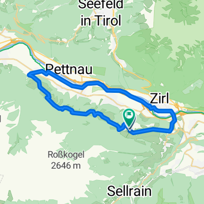
- Ranggen, Tyrol, Austria
A cycling route starting in Ranggen, Tyrol, Austria.
Overview
Training loop forest and forest path 10%, dirt road 10%, asphalt 80%
created this 8 years ago
Route quality
Quiet road
7 km
(57 %)
Track
5 km
(41 %)
Path
0.2 km
(2 %)
Paved
0.7 km
(6 %)
Unpaved
2.3 km
(19 %)
Unpaved (undefined)
2.3 km
(19 %)
Paved (undefined)
0.7 km
(6 %)
Undefined
9.2 km
(75 %)
Continue with Bikemap
You would like to ride 12km Laufrunde or customize it for your own trip? Here is what you can do with this Bikemap route:
Free trial for 3 days, or one-time payment. More about Bikemap Premium.
Discover more Premium features.
Get Bikemap PremiumFrom our community
Open it in the app


