

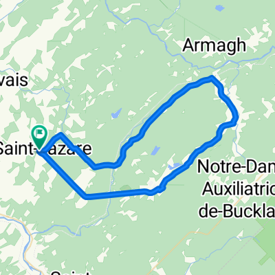
Armagh-Pintendre
A cycling route starting in Bellechasse Regional County Municipality, Quebec, Canada.
Overview
About this route
- -:--
- Duration
- 76.9 km
- Distance
- 53 m
- Ascent
- 263 m
- Descent
- ---
- Avg. speed
- ---
- Max. altitude

Route quality
Waytypes & surfaces along the route
Waytypes
Cycleway
75.4 km
(98 %)
Road
0.8 km
(1 %)
Undefined
0.8 km
(1 %)
Surfaces
Paved
76.1 km
(99 %)
Asphalt
70 km
(91 %)
Paved (undefined)
6.2 km
(8 %)
Undefined
0.8 km
(1 %)
Continue with Bikemap
Use, edit, or download this cycling route
You would like to ride Armagh-Pintendre or customize it for your own trip? Here is what you can do with this Bikemap route:
Free features
- Save this route as favorite or in collections
- Copy & plan your own version of this route
- Sync your route with Garmin or Wahoo
Premium features
Free trial for 3 days, or one-time payment. More about Bikemap Premium.
- Navigate this route on iOS & Android
- Export a GPX / KML file of this route
- Create your custom printout (try it for free)
- Download this route for offline navigation
Discover more Premium features.
Get Bikemap PremiumFrom our community
Other popular routes starting in Bellechasse Regional County Municipality
 St-Damien-de-Buckland - Montmagny
- Distance
- 59.6 km
- Ascent
- 134 m
- Descent
- 459 m
- Location
- Bellechasse Regional County Municipality, Quebec, Canada
 St-Lazare Bellechasse - boucle 63 km, 730 m
- Distance
- 62.7 km
- Ascent
- 580 m
- Descent
- 580 m
- Location
- Bellechasse Regional County Municipality, Quebec, Canada
 maison 32km 220m
- Distance
- 32 km
- Ascent
- 265 m
- Descent
- 265 m
- Location
- Bellechasse Regional County Municipality, Quebec, Canada
 la capricieuse
- Distance
- 123.7 km
- Ascent
- 792 m
- Descent
- 792 m
- Location
- Bellechasse Regional County Municipality, Quebec, Canada
 Saint-Lazare Bellechasse - boucle 52 km, 420 m
- Distance
- 52.1 km
- Ascent
- 396 m
- Descent
- 396 m
- Location
- Bellechasse Regional County Municipality, Quebec, Canada
 boucle piste cyclable Ste-Claire, St-Malachie, St-Lazare
- Distance
- 43.9 km
- Ascent
- 379 m
- Descent
- 378 m
- Location
- Bellechasse Regional County Municipality, Quebec, Canada
 route pour aller chez Diane
- Distance
- 400.2 km
- Ascent
- 1,811 m
- Descent
- 1,811 m
- Location
- Bellechasse Regional County Municipality, Quebec, Canada
 Cycloroute de Bellechasse
- Distance
- 83.4 km
- Ascent
- 29 m
- Descent
- 264 m
- Location
- Bellechasse Regional County Municipality, Quebec, Canada
Open it in the app