Sustentur Alcoutim Tour
- 36.2 km
- 654 m
- 648 m
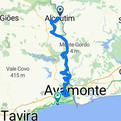
- Alcoutim, Faro District, Portugal
A cycling route starting in Alcoutim, Faro District, Portugal.
Overview
Alcoutim - EM-507 - Corte Pereiras - EM-507 - Alfonso Vicente - Santa Maria - EM-507 - Cerro da Vinha de Baixo - Tesouro - EM-507 - ER-124 - EM-508 - Alcaira Cova - EM-508 - Soudes - Preguicas - EM-508 - Monte da Estrada - EM-512 - Alta Mora - EM-512 - Magoito - EM-512 - Corujos - EM-512 - Brenhosa - EM-512 - Quebradas - Portela Alta - Anschlussstelle IC 27 - EN-122 - Reservatório de Vale de Gato - EM-1063 - Fonte do Penedo - EM-1063 - Alcaira - EM-1063 - Foz de Odeleite - EM-507-2/GUADAIANA - Àlamo - EM-507/GUADAIANA - Guerreiros do Rio - EM-507/GUADAIANA - Laranjeiras - EM-507/ GUADAIANA - Alcoutim
created this 8 years ago
Route quality
Road
62.5 km
(75 %)
Quiet road
14.2 km
(17 %)
Paved
14.2 km
(17 %)
Asphalt
7.5 km
(9 %)
Paved (undefined)
6.7 km
(8 %)
Undefined
69.2 km
(83 %)
Continue with Bikemap
You would like to ride P 001: Alcoutim or customize it for your own trip? Here is what you can do with this Bikemap route:
Free trial for 3 days, or one-time payment. More about Bikemap Premium.
Discover more Premium features.
Get Bikemap PremiumFrom our community
Open it in the app